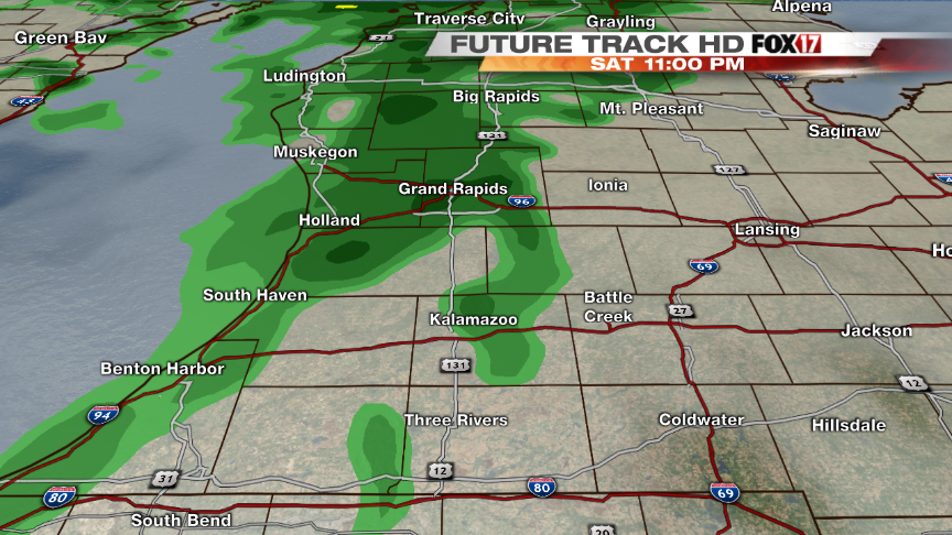
(WEST MICHIGAN) — Rain showers and some wet snow north of Grand Rapids will move off this morning but windy conditions will prevail through the afternoon and evening hours. Better chances for more widespread rain will increase through late afternoon and continue on through the evening. Heaviest rains will stay along the lakeshore and north of I-96 with some rumbles of thunder being possible overnight. Rain will quickly exit by Sunday morning allowing for some afternoon clearing. Temperatures will stay in the 50’s through the end of the weekend before starting on a warming trend. Much warmer temperatures and a more active pattern will prevail into the new work week with temperatures starting in the 60’s and warming near 70 for mid-week.
April Showers Bring May Flowers

This is an archived article and the information in the article may be outdated. Please look at the time stamp on the story to see when it was last updated.
Leave a Reply
4 comments
-
Rain, snow, freezing rain, and thunderstorms tomorrow
-
Freezing rain expected farther south Sunday
-
Weekend Winter Storm Watch
-
Rain moves in to start the work week in West Michigan
-
Strong spring weekend storm hits West Michigan
-
-
Be prepared for a snowy commute Tuesday AM
-
A mostly cloudy sky as flooding continues in West Michigan
-
Foggy through Monday with rain picking up
-
Colder temperatures moving into West Michigan
-
A mostly sunny Sunday throughout West Michigan
-
-
Weekend storm to bring wind, rain, ice, and cold
-
Snow showers heading towards West Michigan
-
A mostly sunny weekend in West Michigan
Ken
But what do May flowers bring?
Peter
pilgrims
jim
Babys
jim
Oops Babies