

KENTWOOD, Mich. (July 7, 2014) — Severe thunderstorms ripped through southern Kent County on Sunday evening wreaking havoc across the communities of Kentwood, Wyoming, and Cutlerville. On Monday the National Weather Service will conduct a damage survey of the area(s) to determine whether strong straight line winds or an actual tornado touched down.
Witnesses claim they saw a funnel cloud and the damage is certainly extensive enough to be tornadic. That said, strong damaging straight line winds (like those found in a microburst) can do just as much damage as some tornadoes. If you’ve never heard the term, a microburst is a localized column of sinking air caused by an intense downdraft.
The real difference between a microburst and tornado is that when wind from a microburst hits the surface, it tends to fan out in all directions (think of a water balloon being dropped on the ground). Damage from a tornado will typically be in one direction or have some circular attribute. This is what NWS Meteorologists will be looking for in their damage survey. See microburst depiction below.
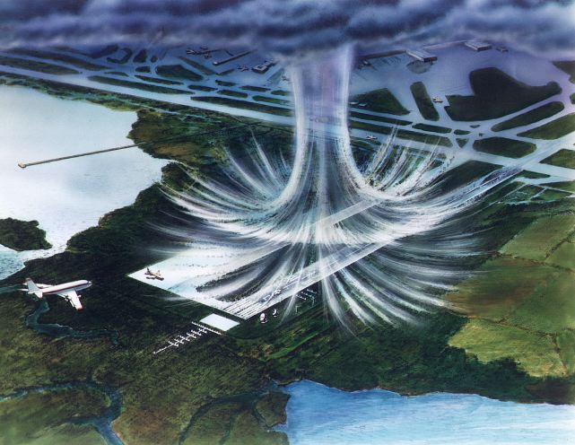
Here is a hand-drawn image (below) of typical wind damage patterns with a microburst and a tornado.

The main photo attached to this story was submitted by Dustin Moroski. Make sure to post your photos to our FOX 17 Facebook page.
