

Wednesday and Thursday
![]()
West Michigan – More arctic air is schedule to move into the area the next several days with significant lake-effect snow. A Winter Storm Watch has been posted for Wednesday and Thursday mainly south and southwest of Grand Rapids.
West winds will become mainly northwest on Wednesday as the coldest air starts to slide into the state. This will set-up the heaviest snow bands along the lakeshore and one county inland in the watch area.

Forecast snowfall through Wednesday evening will range from 1-2 inches east of US 131 to 3-5 inches right along the lakeshore.
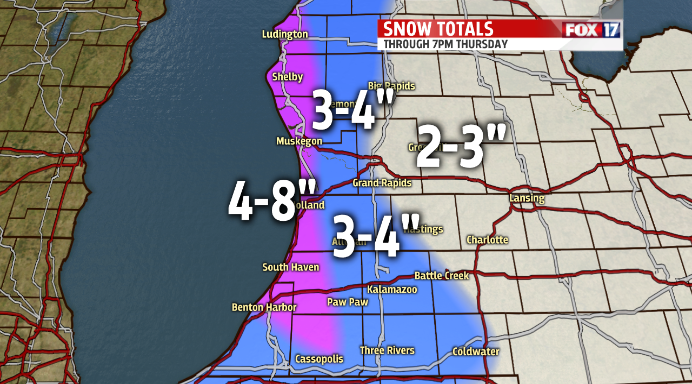
Snowfall amounts by Thursday evening will reach 4-8 inches along the lakeshore with isolated amounts approaching 10 inches possible.
For the complete forecast go to www.fox17online.com/weather
