
WEST MICHIGAN- Our best chance for widespread severe weather occurs today in West Michigan, as we see two separate frontal systems pass through the area today. Our first disturbance, a warm front lifting from the southwest, already has a history of producing damaging straightline winds in the Midwest.
Here’s a projection of when to expect this first system to arrive, according to Future Track HD:

This first round of storms look to continue throughout the early afternoon hours.

The main concerns with this first round of storms are damaging straightline winds, large hail, and heavy rain. Depending on how much sunshine we receive after the first round, we could have an increased severe threat this evening as well. Timeline is from 1 pm to 12 am with a gap of clearing between 5-8 tonight.
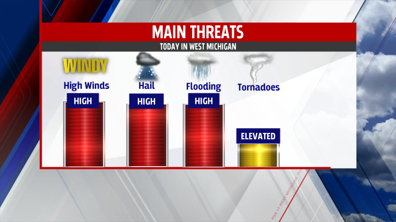
What can be expected from these storms? Main threats are gusty winds of 70 mph or greater, quarter size hail, and flooding from torrential downpours. Tornadoes are a threat, but a much lower one in comparison, and have the best opportunity to form with the second round of storms in the evening. Keep it tuned it to FOX 17 online and on the air for the latest severe weather updates throughout the day.
