
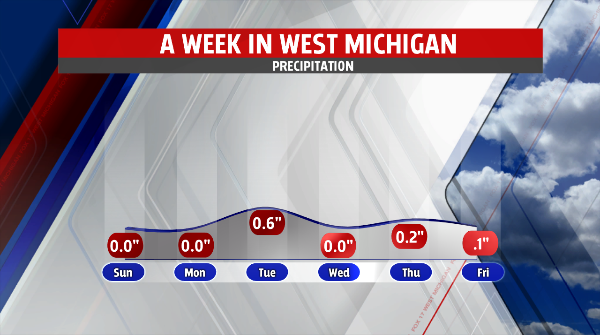
 WEST MICHIGAN — (May 3, 2014) It has been a grey and gloomy week around West Michigan as a slow-moving low pressure brought multiple chances for light rain throughout the week and although the rain wasn’t particularly heavy it was patchy, light and persistent.
The rain and cool temperatures will start moving out of West Michigan Saturday as the slow-moving low moves east and northeast. The cold front is moving across the state already and will help usher in some drier Canadian air by late afternoon. This drying out will help bring some sunshine back into the region by late afternoon however the chance for a slight stray rain drop or two will be possible.
Temperatures will continue to drop behind the front overnight tonight making for a chilly start to Sunday morning. Some areas that see clearing skies by sunrise may have the chance to develop a light frost. Temperatures will continue to warm as we head through the end of the weekend and the beginning of next week. Rain will also hold off for the first half of the new work week.
