
MIAMI, Fla. (CNN) — Hurricane Dorian is now an even stronger 145 mph hurricane, category 4 storm, according to the noon Saturday advisory from the National Hurricane Center in Miami.
It is likely to remain a very intense hurricane Saturday as it moves toward the northern Bahamas, where hurricane warnings remain in effect.
Hurricane watches may be issued for parts of the Florida East Coast later on Saturday.
The forecast track has been shifted east and no longer shows a landfall in Florida but instead in Georgia and the Carolinas. But Floridians should not relax just yet.
Much of Florida remains in the “cone of uncertainty” meaning even a small shift would bring the very dangerous core of the storm inland to Florida.
Even if the storm doesn’t make landfall in Florida, much of the state will still experience life threatening storm conditions like hurricane force winds, storm surge, and flash flooding.
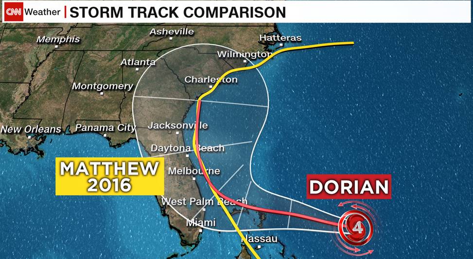
If the current forecast verifies, it will be very similar to the track taken by Hurricane Matthew, a storm that did nearly $5 billion worth of damage in Florida, Georgia and the Carolinas.
The timing is similar to the previous forecast for the U.S. with tropical storm force winds arriving Sunday night and hurricane conditions possible late Monday into Tuesday.
With the current forecast, Georgia and the Carolinas are now at risk for landfall on Wednesday into Thursday.
And the hurricane could cause catastrophic damage in the Bahamas Sunday into Monday, particularly on Abaco and Grand Bahama Islands.
