


WEST MICHIGAN - Moderate to very heavy rain fell across portions of our FOX 17 viewing area on Tuesday. What started out as some light showers early in the morning, turned very heavy after rain and thunderstorms "trained" over the exact same areas and locations for hours! Training showers and storms is a term used when the same locations are hit with hour after hour of precipitation. This can lead to rising creeks, rivers, streams, and eventually area wide flooding. Both Muskegon and Holland recorded record rainfall for September 24. The official total in Muskegon was 4.43", breaking the old record of 1.20" set in 1977. That was their second highest single day rain total on record. Their first was 5.08" set on June 27, 1921. Holland also broke a record on Tuesday with 1.91" being tallied. The old record was .9" set in 1926. We have unofficial viewer reports that anywhere from 6" to 9" of rain may have fallen across parts of Muskegon County.
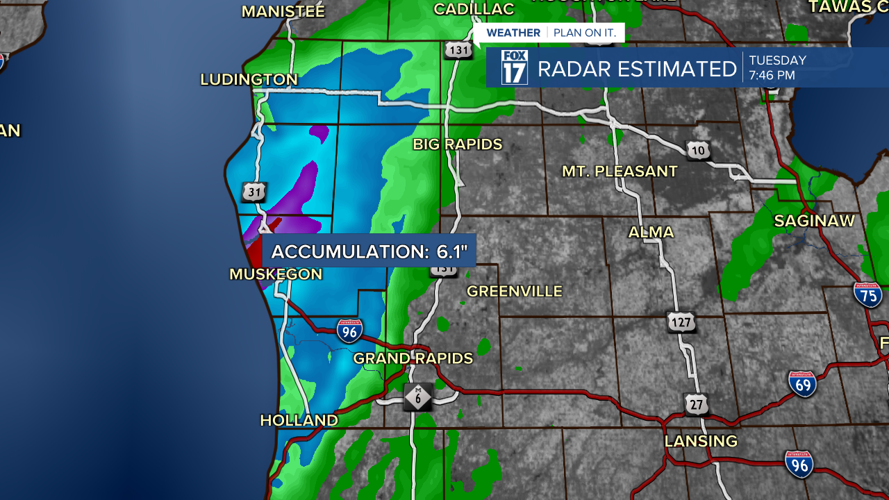
The image attached to this story shows radar estimated precipitation. Areas in blue saw about 2" to 3", areas in purple 4" to 5", and the bulls-eye in red around Muskegon may have been 6" or more according to radar estimates. Note also that some areas saw little/no rain. Take a look at the close up image below.
A FLOOD WARNING remains in effect for Muskegon County into Wednesday morning due to all the rain! Other areas that picked up moderate to heavy rain include Ottawa, Oceana, and Newaygo Counties. Make sure to watch out for ponding on roads, and rapidly rising tributaries. Make sure never to drive through standing water. It takes less than 18" of water to float most vans and SUV's. Please be safe!
Our forecast has drier weather for Wednesday afternoon, Thursday, and Friday, before some tropical moisture from Helene may affect our region this weekend. Get the complete forecast at www.fox17online.com/weather.