


WEST MICHIGAN — Since the Arctic blast in mid-January exited the Grand Rapids area, most communities have measured just 2" to 3" of snow in that two week stretch. Now, we finally have a system looking to bring significant snow once again.
A strengthening low pressure system will track into the Great Lakes from the Central Plains Saturday. Most of West Michigan are in the bullseye for snowfall, but our southern communities will have some mix precipitation.
The snow sector of this event will arrive sometime early to midday Saturday.

Impacts from snow or wintry mix don't look to be felt until the later part of Saturday, as more moisture feeds into Michigan from the southerly wind ahead of the low.


Most of the area will be clear of the system come sunrise Sunday. There are indications a colder blast of air will move in behind the system with a northerly wind, supporting some lake effect snow Sunday.
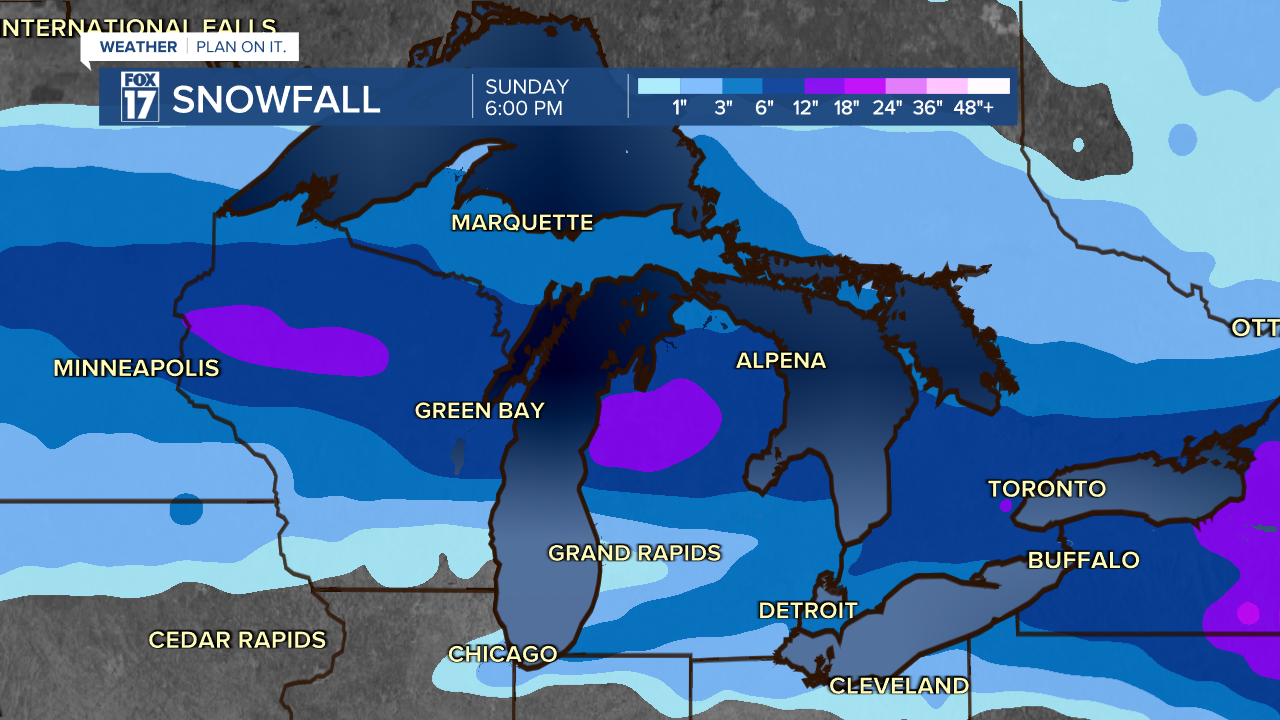
Overall, heavier snowfall looks to be along/north of I-96. The likely warmer air along/south of I-94 supports less snow and more freezing rain. Here's where the highest totals are expected between Friday and Sunday.

Thankfully, the brunt of this system has trended south, and so as the freezing rain banding. We are looking at all snow in West Michigan, but some will get very little depending on the exact track!
The timing of this snow is worth watching for Saturday evening travel disruptions.
Stay tuned to FOX17 for the latest updates on freezing rain impacts and the timing of heavier snow in West Michigan.