WEST MICHIGAN - Similar to this past week, heat and humidity will start to build again by Monday as highs will reach the upper 80s to near 90. It also appears as if the the heat may set up shop for the better part of next week. We don't have too many shower/storm chances, but there are a couple.
Normal highs for this time of year have us around 80. These are some of the longest days of the year with more than 15 hours of daylight. The summer solstice is just around the corner June 21.
We have the chance at a stray shower/storm on Sunday as warm air tries to push into Michigan. Most of us won't see this, but rain chances do exist. See image from our forecast model valid for 3 P.M. Sunday.

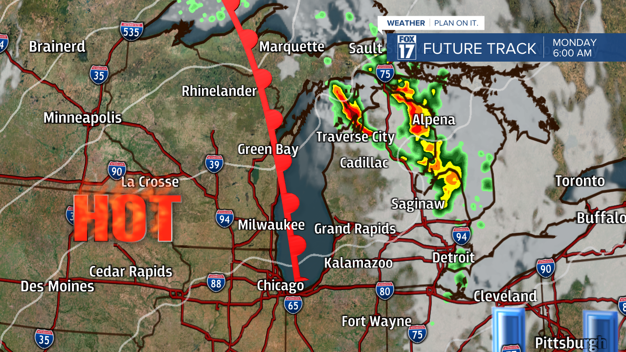
The warm front will lift through the state on Monday and most of the shower/storm activity associated with this front is expected north/east of our area at that time. See image below valid for 6 A.M.Monday.

Temperatures Monday will make a run into the upper 80s, then likely the lower 90s for Tuesday. See high temperatures on Tuesday below.

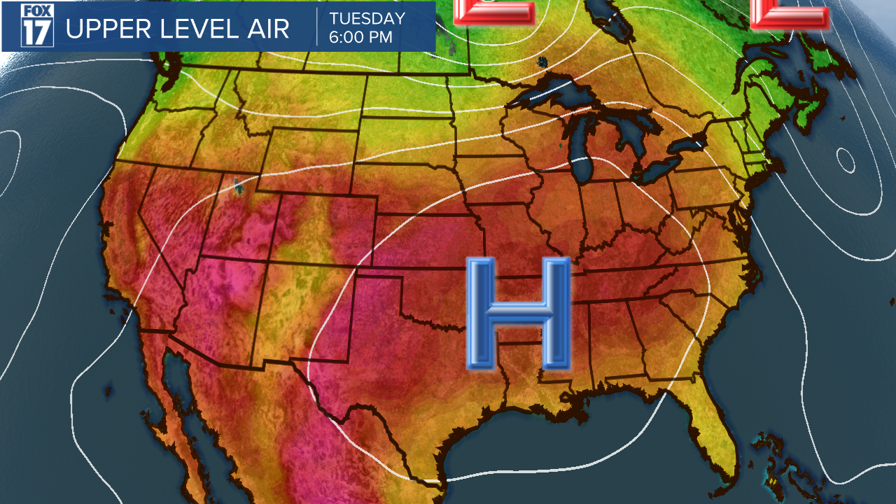
The upper level jetstream pattern below shows the colors on the map that represent air masses and hot tones building in by Tuesday. Note the bubble, or ridge of high pressure building from the surface to the upper levels of the atmosphere.

Get the complete West Michigan forecast at www.fox17online.com/weather.


