WEST MICHIGAN — After rapid wind gusts on Friday night into Saturday morning, another blast of howling wind gusts returns for Sunday in West Michigan. Here's a look at the highest reported wind gusts from late Friday night into early Saturday morning.

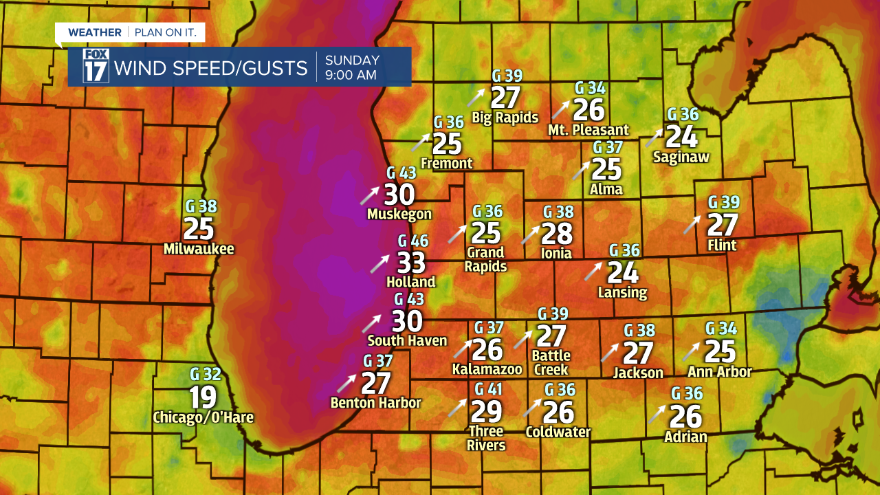
The estimated wind gusts for Sunday are expected to a little lighter than Friday nights event, but still strong! Model guidance suggests wind gusts upwards of 45 mph on Sunday afternoon, with isolated wind gusts up to 50 mph possible. Below is the estimated sustained winds and wind gusts for 9 a.m. Sunday morning.

The sustained wind speed is represented by the number in white, with the estimated wind gusts represented by the smaller number in blue. Wind gusts are likely going to stay strong through Noon, eventually calming down later in the evening hours. The biggest gusts are expected to be along the lake shore and north of Grand Rapids.

With wind gusts exceeding 45 mph, blowing and drifting snow will be a concern, generating reduced visibility for a period of time. Locations closer to the lake shore will see the greatest impacts for visibility, as that is where the highest wind gusts are expected.
Isolated power outages are also possible on Sunday, along with downed tree limbs.
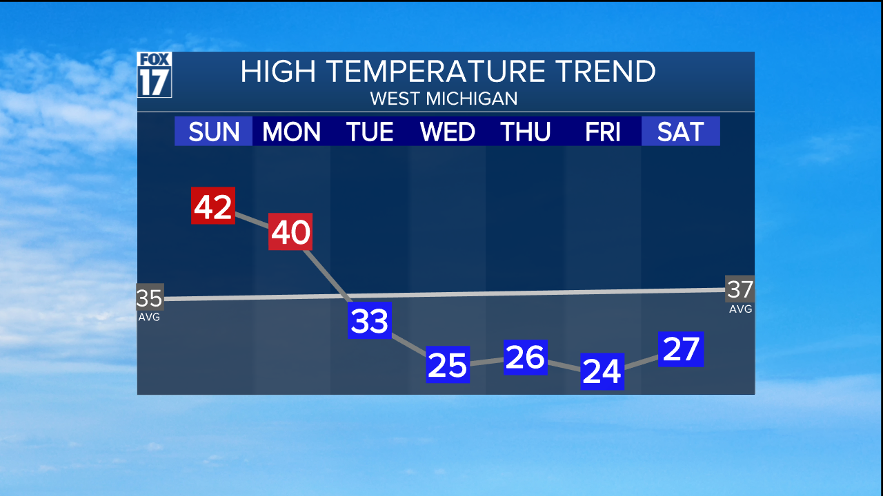
A good take on Sunday's wind speed is the rise in temperatures associated with them! With winds shifting and coming from the southwest, warmer temperatures are in store for Sunday. The high temperatures are likely to climb to the lower 40s for Sunday and Monday.

Stay tuned with FOX 17 for the latest advisories and alerts.


