WEST MICHIGAN - For every person that looks forward to seeing the first snowflakes fly, you'll find two more that say "wait"! If it seems a bit early for snow, it is. While we're only expecting flakes to possibly mix in with rain showers Monday and Tuesday, our first real accumulating snow typically arrives in early November.
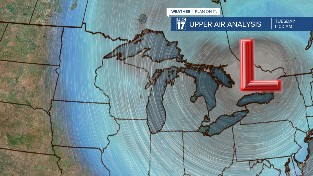
It's not magical why the snow may fly next week. It's directly related to our upper level jet stream that will be dipping to the south with a huge trough over the Great Lakes and Midwest. Take a look at the image below. The colors on the map represent the airmass and the gray and light blue is significant colder air aloft. That air will will generate lake effect rain (possibly snow showers mixing in) with a cold wind directly out of the north around/behind the low.

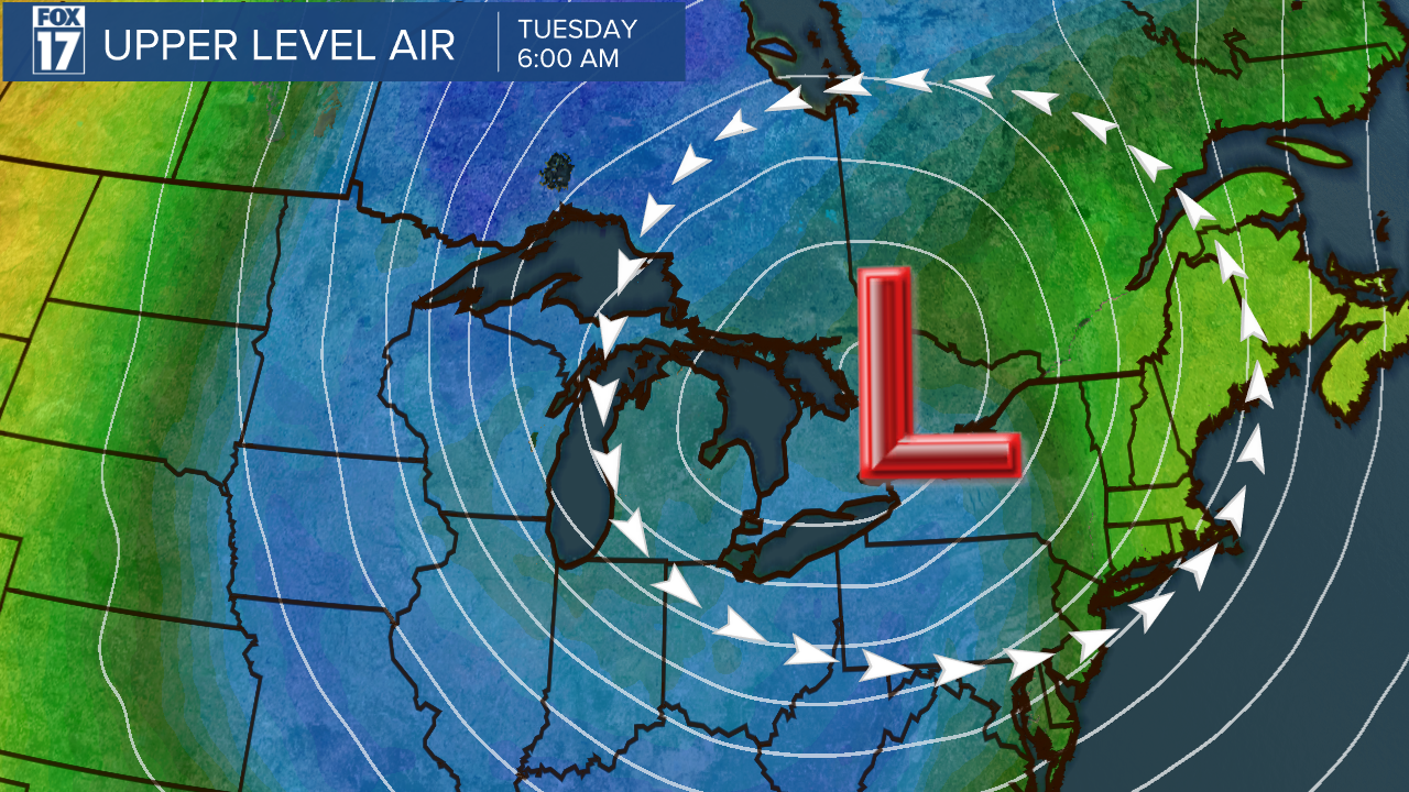
In another map perspective, see the image below of airmass colors around the entire United States. Again, the warmest temperatures are in the West, Southwest, and along the Gulf Coast (warmer colors of yellow and red). The colder tones of blue are over the Great Lakes where the coldest air spills south from Canada.

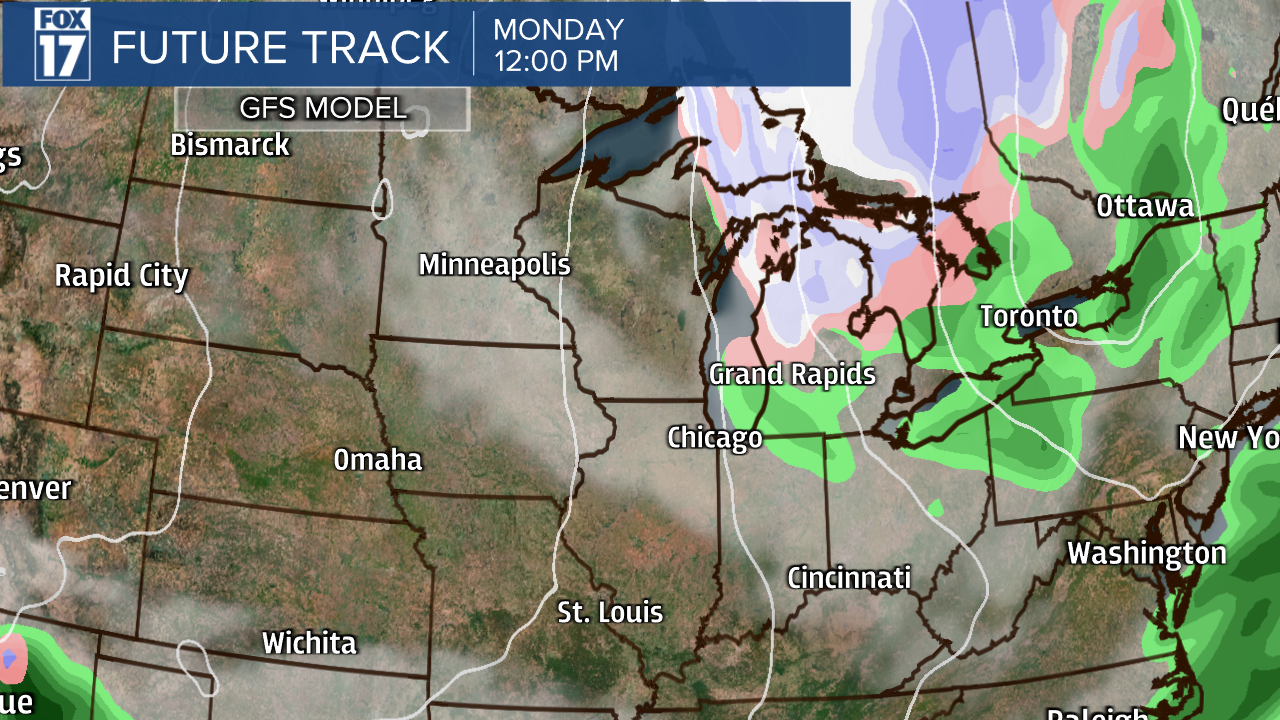
Our forecast models are also hinting at the possibility of a rain/snow shower mix on Monday and Tuesday. Below is an image from our GFS Model valid for noon Monday. Note the blue (snow), pink (rain/snow mix), and green (rain).

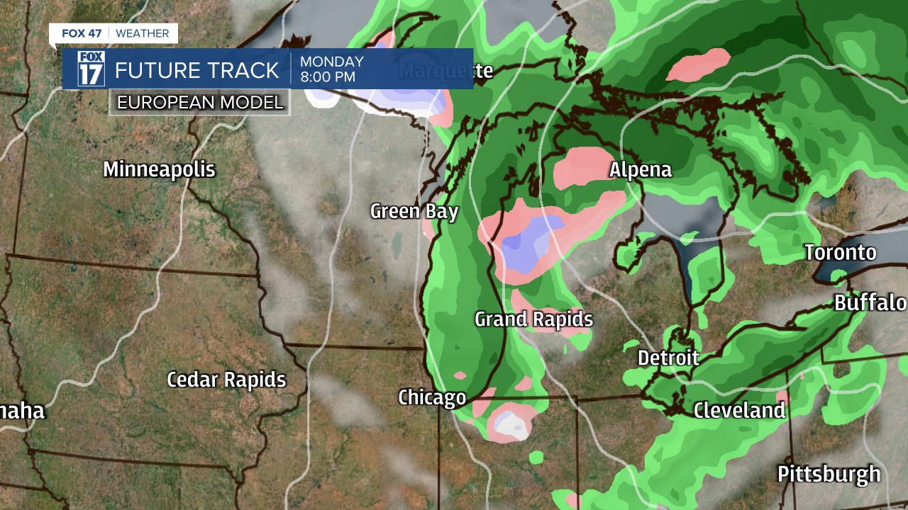
The next image below is from the European Model and is valid for 8 P.M. Monday. Note the rain/snow mix (pink) on this map too...especially from Grand Rapids northward.

High temperatures next week are only expected in the middle 40s, with lows at/below freezing. Get the complete West Michigan forecast at www.fox17online.com/weather.


