WEST MICHIGAN - While it may be difficult to think of winter weather over the next two days with highs around 60 and sunshine, a change to sharply colder, winter-type weather may be upon us later this week. A powerful fall storm is expected to track into the Upper Midwest impacting several states, including Michigan. Strong, gusty winds with 40 to 50 mph gusts, plus rain, and perhaps accumulating lake-effect snow are all possible beginning Wednesday night and continuing into Saturday.
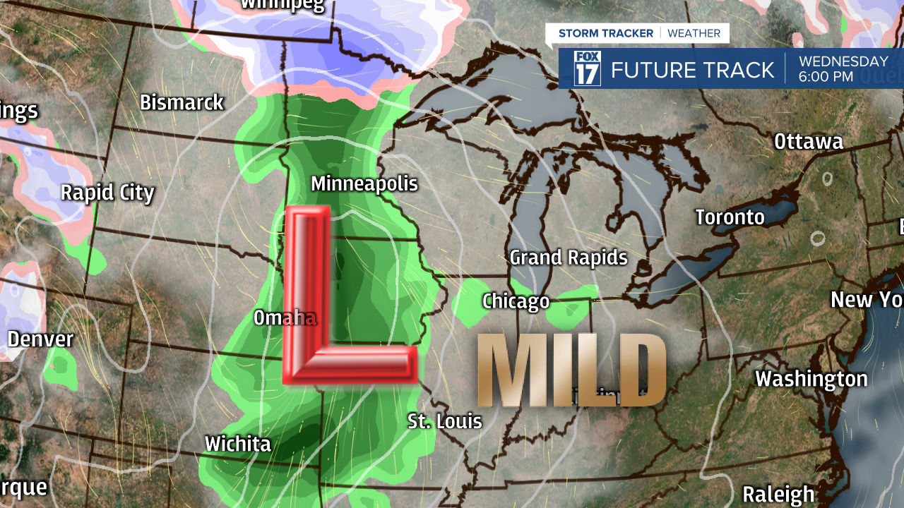
The image below shows our computer forecast model at 6 P.M. Wednesday. Note the low pressure system over western Iowa. Initially, we'll be on the front side of this system in the mild air with highs in the upper 50s on Thursday. Rain will likely develop and winds will start ramping up as early as Wednesday afternoon/evening.
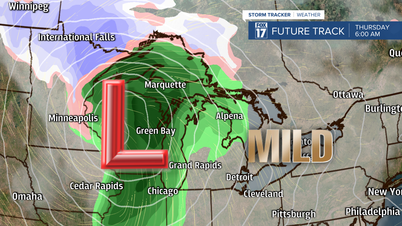
The next image shows the progression of the low further north and east into western Wisconsin. This image is valid for 6 A.M. Thursday. By this time, winds are very strong from the south and rain will be on the cusp of developing across our area.
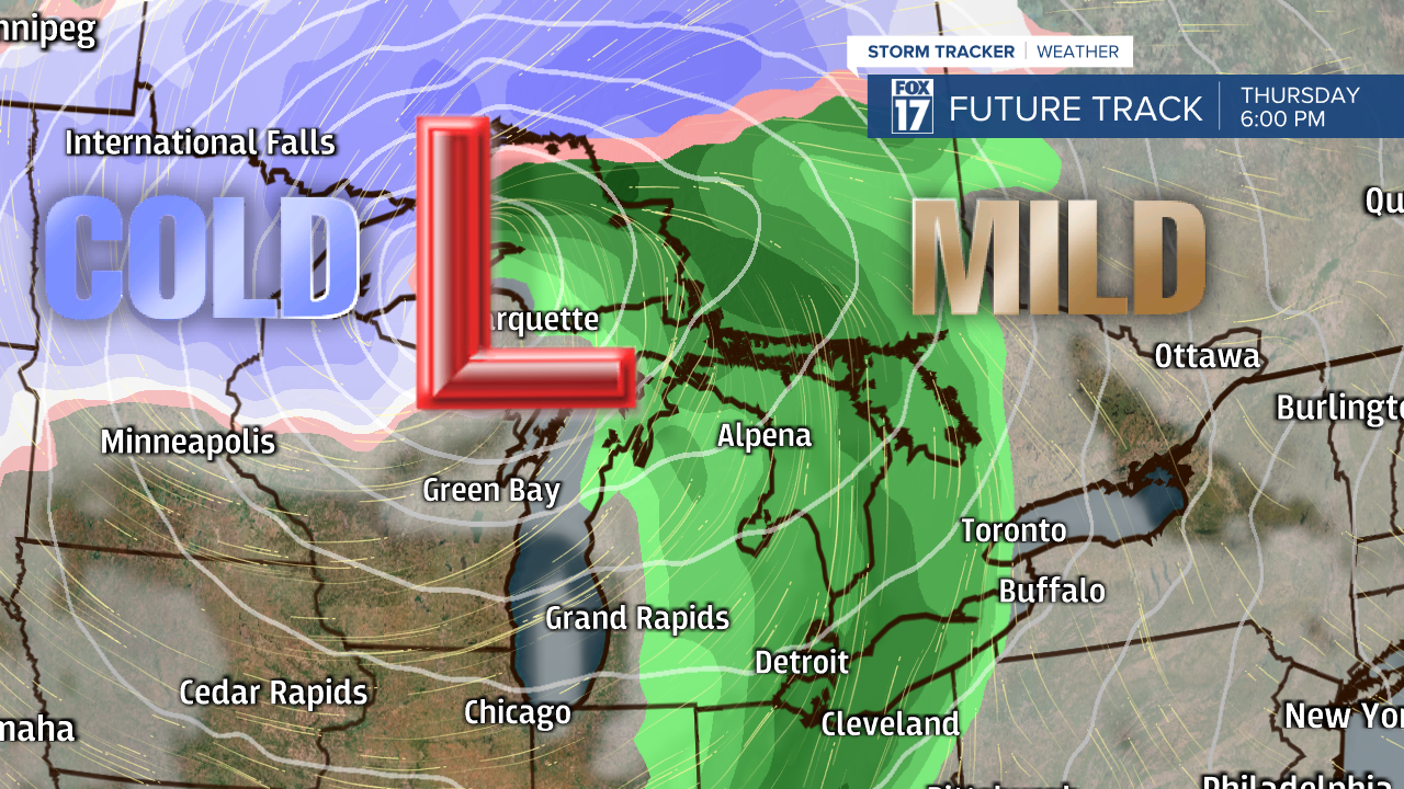
By 6 P.M. Thursday in the image below, the low has moved into the western U.P. with rain across our area, gusty winds, and still somewhat mild temperatures in the 50s. It's possible winds may gust to 50 mph at the lakeshore!
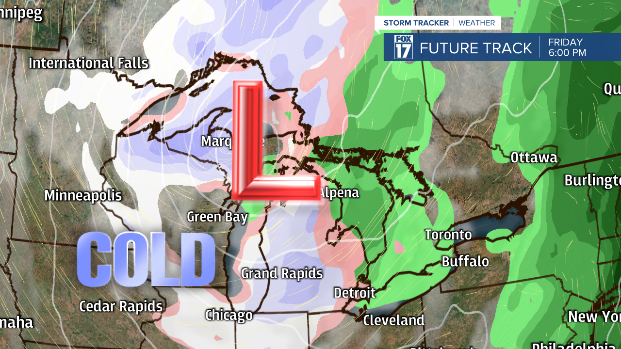
By 6 P.M. on Friday (below), sharply colder air will infiltrate the Great Lakes with lake-effect rain showers mixing with, and perhaps completely changing to snow showers late in the day. Temperatures will likely fall throughout the day and accumulating snow is certainly possible. We'll know more as we get a little closer to the actual event as timing and track may change a bit.
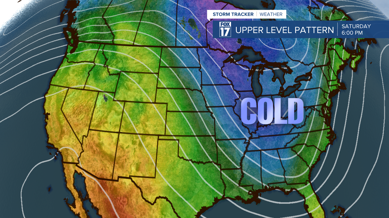
It's also worth noting that driving this pattern change to colder weather and the possibility of lake-effect snow, will be our upper level jet stream. Notice the huge dip or trough over the Great Lakes and colder air mass colors by Saturday, allowing for all the cold air to spill south from Canada. In fact, below normal temperatures and this cold air will likely penetrate as far south as Mississippi, Alabama, and Florida.
Make sure to stay up on later forecasts as the track of this system may change slightly and the intrusion of cold air may occur faster or slower. Get the complete West Michigan forecast at www.fox17online.com/weather.


