


WEST MICHIGAN — The National Weather Service in Grand Rapids has EXPIRED the Tornado Warning in effect for Mecosta county.
Tornado Warning including Canadian Lakes MI, Morley MI and Mecosta MI until 7:45 PM EDT pic.twitter.com/iBhzR4lAwA
— NWS Grand Rapids (@NWSGrandRapids) May 20, 2024
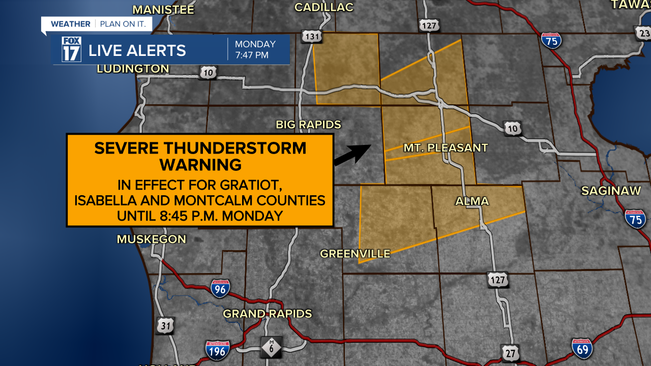
The National Weather Service in Grand Rapids has issued a Severe Thunderstorm Warning for Gratiot, Isabella, and Montcalm counties until 8:45 p.m. Monday. These storms are shifting out of the FOX 17 News viewing area now. The storms are moving northeast at 30 mph.
The Storm Prediction Center has issued a Severe Thunderstorm Watch for West Michigan until 10 p.m. Monday. This means that severe weather is possible.
3:42pm CDT #SPC_Watch WW 268 SEVERE TSTM MI LM 202040Z - 210200Z, #miwx #lmwx, https://t.co/hhHEkYnPbF pic.twitter.com/Oh6NvsxG53
— NWS Storm Prediction Center (@NWSSPC) May 20, 2024
The Severe Thunderstorm Watch is in effect for Allegan, Barry, Calhoun, Clinton, Eaton, Gratiot, Ingham, Ionia, Isabella, Jackson, Kalamazoo, Kent, Mecosta, Montcalm, Muskegon, Newaygo, Oceana, Ottawa, and Van Buren counties.

The main threat for these storms will be wind gusts over 60 mph. Hail will be possible, along with a low-threat for an isolated tornado.
Here is a look at the LIVE FOX 17 News Interactive Radar.
Scattered showers and thunderstorms are in the forecast for West Michigan this evening with a SLIGHT RISK for severe thunderstorms. The National Weather Service Storm Prediction Center has upgraded out risk for this evening.

Click here for more information regarding the severe weather potential in West Michigan this evening.
Stay alert with the FOX 17 Weather Team for all updates. For the latest details on the weather in West Michigan, head to the FOX 17 Weather page.
Follow FOX 17: Facebook - X (formerly Twitter) - Instagram - YouTube
