


WEST MICHIGAN — It's been an active weather day in West Michigan! A cold front swept across the region in the morning, firing up strong thunderstorms and strong wind gusts. Below is a breakdown of the timing, wind speeds, severe weather potential, and current alerts through the rest of tonight.
TIMING
Additional showers and a few thunderstorms will develop for Thursday afternoon and evening, however they will be isolated in nature. There is a potential for strong to severe thunderstorms to develop through this evening, however the threat remains low.
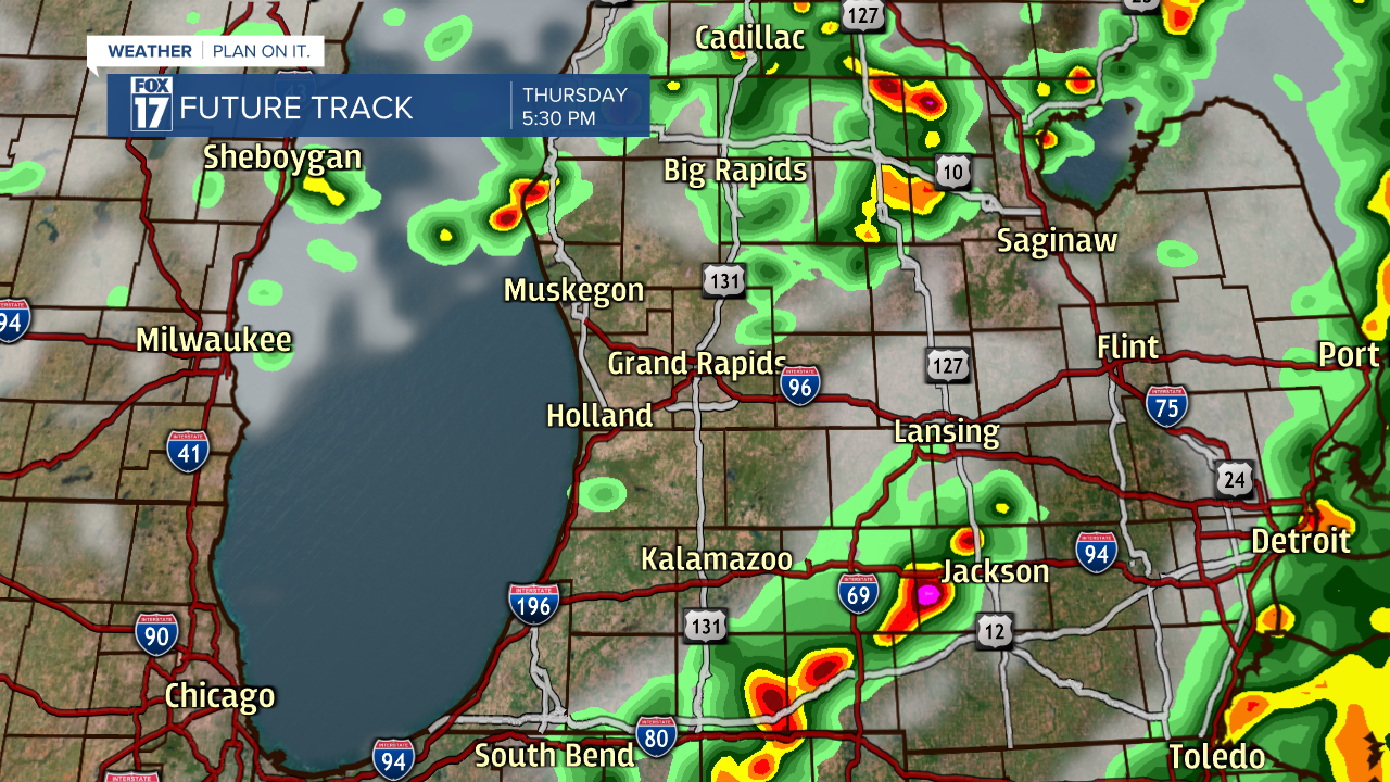
Heavy rain, frequent lightning, strong wind gusts, and hail will be possible.
WIND SPEEDS
Now that the cold front has passed, winds are now strong from the northwest. Wind gusts will exceed 35 mph, with sustained winds ranging between 10 to 25 mph.
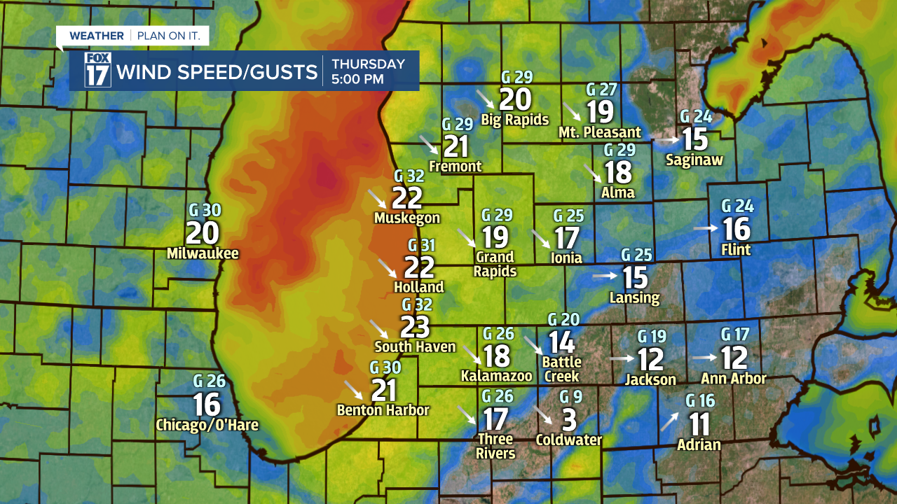
Waves in Lake Michigan through this evening could range up to 6 feet. Please do NOT swim or boat in Lake Michigan. Trash cans could be toppled over, in addition to other light-weight outdoor items. Bring your trash can and lawn chairs in.
SEVERE WEATHER POTENTIAL
The Storm Prediction Center has already placed West Michigan under a MARGINAL RISK for severe storms on Thursday. This is the lowest level category for severe storms, a 1 out of 5 on the scale. The region that has the greatest potential of strong to severe weather will be along and east of U.S. 131 through Thursday evening.
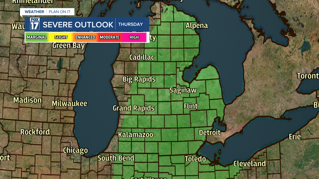
The main threats include damaging wind gusts and small hail. Heavy rain and frequent lightning will be possible for all of West Michigan. As a reminder, in order for a thunderstorm to be considered severe it must meet one of two requirements: wind gusts at or above 58 mph and/or hail at least 1" in diameter.

Of these threats, wind gusts over 58 mph will be the greatest possibility.
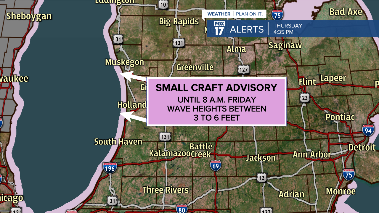
CURRENT ALERTS
The only active alert in West Michigan is a Small Craft Advisory in effect through 8 a.m. Friday. Wind gusts over 30 mph are likely along the lake shore, generating wave heights between 3 to 6 feet. Swimming and boating are NOT advised.
Stay tuned with FOX 17 on air and online for all updates. For immediate severe weather alerts, download the free FOX 17 Weather App. You can also follow us on Facebook, Twitter "X", and Instagram.