


WEST MICHIGAN — It's time to prepare for severe weather in West Michigan! Rounds of strong to severe thunderstorms are in the forecast between now and mid afternoon.
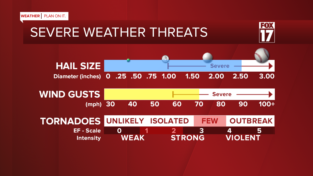
The Storm Prediction Center has issued an outlook placing all West Michigan under an ENHANCED RISK severe storms. This is a level 3 out of 5 for severe storms. There may be multiple waves of thunderstorms, but some of our forecast models show just one main line coming through this morning an early/mid afternoon. The threats for strong wind gusts, large hail, heavy downpours, and a few tornadoes are higher than an average severe weather day.

If we tap into any sunshine today, it will increase our strong to severe storm chances. This is because it adds additional heat, energy, and instability (the air wants to rise) into the atmosphere, which fuels severe thunderstorms. The time is NOW to prepare for these storms. Have multiple ways to receive severe weather notifications, and have a plan in place with your family in case of a tornado warning. Take a look at the percentages below from the Storm Prediction Center regarding wind, hail, and tornado probabilities today.


The risks for these storms includes wind gusts up to 70 mph, hail size up to 2.5" in diameter (that's tennis ball), and a few strong tornadoes. We already had golf ball, ping pong ball, and tennis ball size hail on Tuesday evening with these storms! See images below.

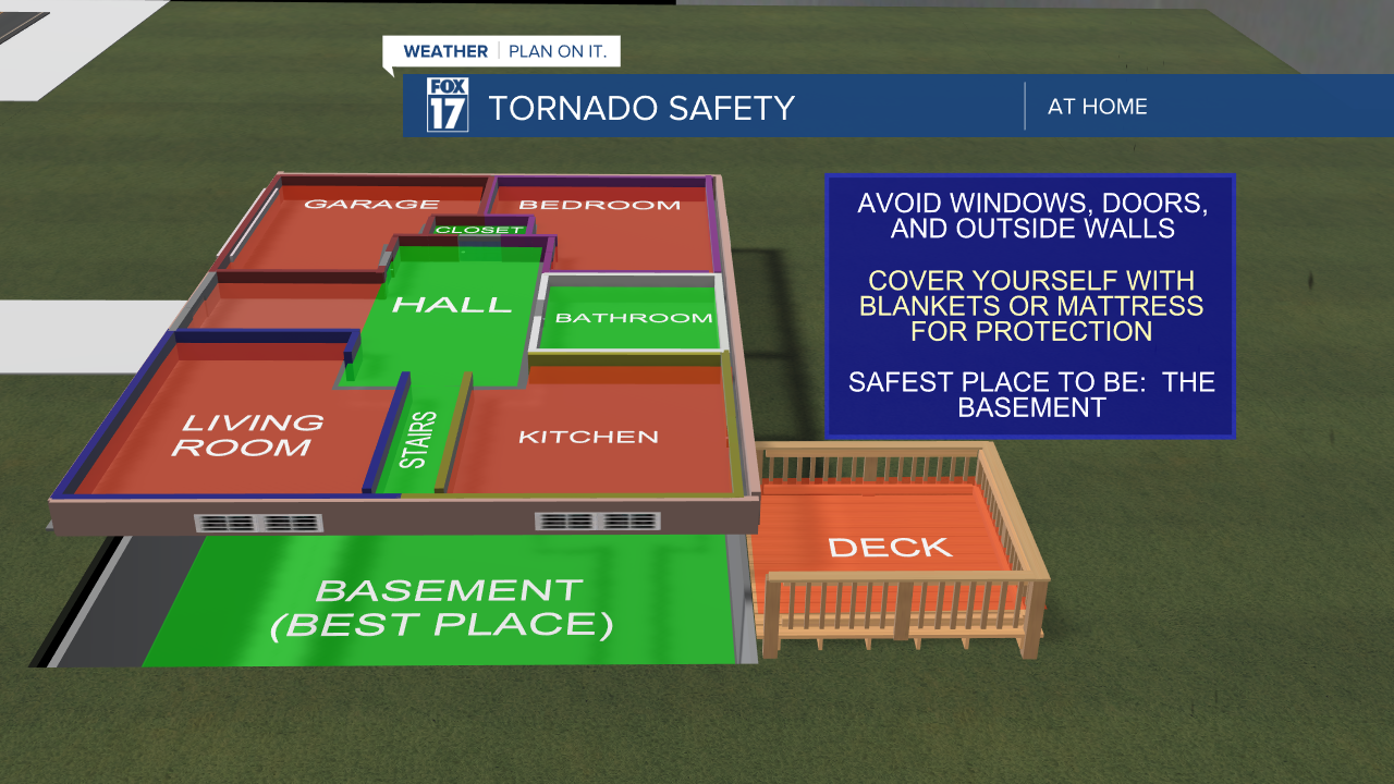
It's a good time for a few reminders on the difference between a watch and a warning, in addition to the safest places to go in your home! If West Michigan falls under a severe thunderstorm watch, it means that severe weather is possible and you should make a plan. A severe thunderstorm warning means that severe weather is occurring and you need to take action!

The best places to go in your home during a tornado warning is in the lowest level, which is normally the basement. If you don't have a basement, find an interior location with no windows. That might be the hallway, closet, or bathroom. Under the stairs is also a great place to go, if you can!
The FOX 17 Weather Team will continue tracking this storm around the clock providing updates consistently. Download the FOX 17 Weather App and stay connected with us on social media for immediate severe weather alerts. You can follow us on air and online!
