WEST MICHIGAN — After packing what seemed like the entire winter season into the month of February, Mother Nature is trying to get back on our good side with milder temps as we head towards and into March.
February saw below normal temperatures and nearly 30" of snow, this after the majority of winter has been mild and pretty much snow-free. Now that we are wrapping up the month and heading into March, it looks like the mild pattern we started the season off with is returning.

Temperatures have been slowly trending into the 40s this week, which is above the normal high of 37° as of February 25th. While this has been nice and allowed a slow thaw to happen across the area, temperatures will get even nicer this weekend and next week.
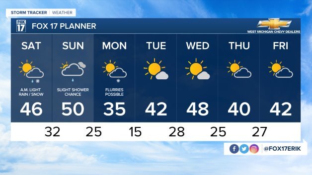
Readings Friday will be back above normal in the lower 40s with plenty of sunshine. The jet stream will trend even further to the north over the weekend with a continued south/southwesterly wind. With the help of some sunshine on Saturday and Sunday, temperatures will make it into the middle/upper 40s. Sunday has the potential of hitting 50°, which would be the warmest day of 2021 so far. A few systems will cross the area Saturday morning and Sunday, but rain/snow chances will remain low. The majority of the daylight hours will be dry!

The warmth won't give up once the weekend is over. After some cooler weather back near normal Monday, we will see the jet stream returning to our north Tuesday and Wednesday. This will provide us with more 40° weather and sunshine. No big storms are on the horizon over the next several days.

Get the complete West Michigan forecast atwww.fox17online.com/weather. Have a good weekend.


