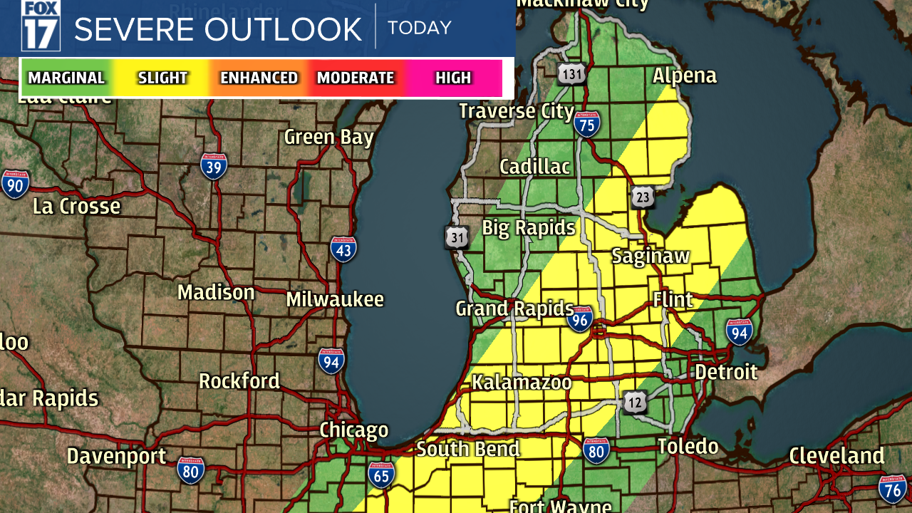
WEST MICHIGAN - After temperatures in the lower 80s on Saturday and lower 70s today, it sometimes is hard to transition back to a cooler, more normal air mass without seeing a round of showers and storms. As a cold front slides through the state this evening, some strong to severe storms will be possible in the mid/late afternoon into the early evening. A bit more sunshine south/east of Grand Rapids will add more heat/energy to the atmosphere with a little higher threat there. The Storm Prediction Center (SPC) has placed Michigan in a SLIGHT RISK. See image below.

Some of these storms could trigger a severe thunderstorm warning if they can produce one inch hail and/or 58 mph winds or stronger. Both are considered marginally severe. That said, a brief, weak isolated tornado is also possible, especially south/east of Grand Rapids where we get a little more sun/heat/energy added to the atmosphere. See the graphic below for our specific severe weather threats as outlined.

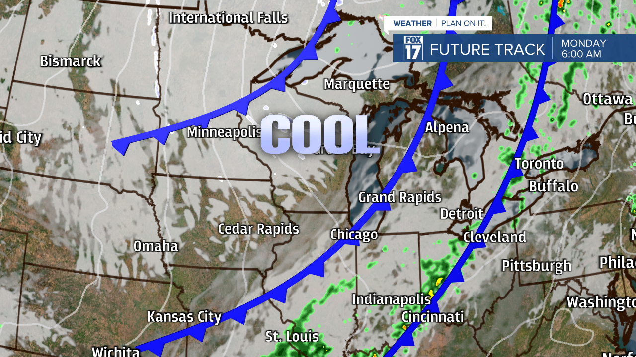
A series of cold fronts marching through the region the next two days will generate sharply colder temperatures by Tuesday and Wednesday. Monday will feature highs in the 50s, while only 40s are expected Tuesday and Wednesday. See image below.

The image below shows the warm air gone and the colder air mass moving in through the week. Mostly cloudy skies are expected to dominate Monday and Tuesday before sunshine returns Wednesday.

Get the complete West Michigan forecast at www.fox17online.com/weather.


