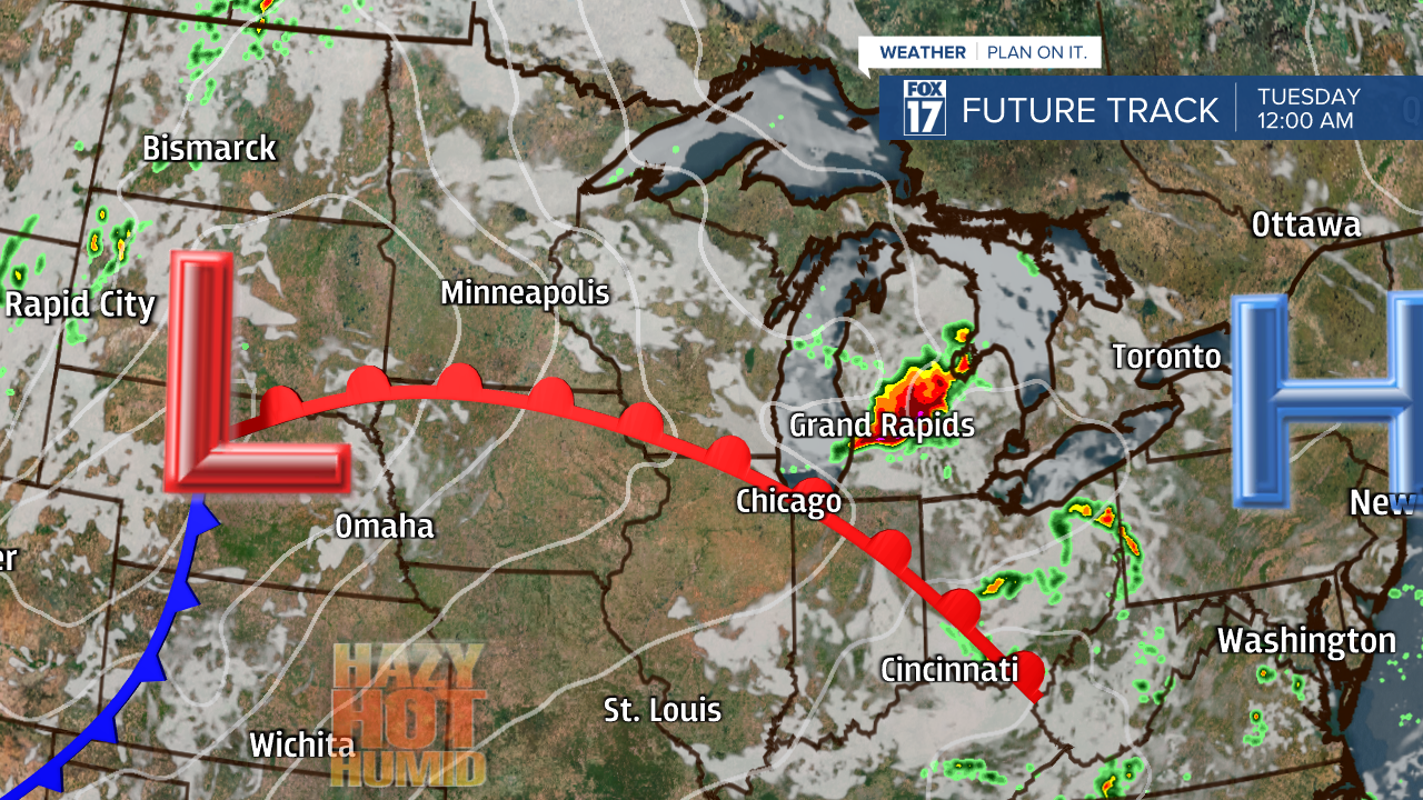
WEST MICHIGAN - Temperatures will be on the warm side today, but look for the heat and humidity to spike by Tuesday and Wednesday as a warm front lifts into the state. The passage of this front this afternoon/evening/night may spark some stronger, perhaps severe storms at that time. See image below valid for 6 P.M. today.

We think there could be two rounds of storms. One in the mid/late afternoon, and perhaps another one in the evening. These storms may contain damaging straight line wind gusts! See our next forecast model image below valid for midnight.

The primary threats would be the chance of some 75 to 80 mph wind gusts, large hail, and perhaps an isolated tornado. Heavy rain is also possible with the moisture-laden airmass that will be transported into the region at that time, so local flooding is possible as well. See the Storm Prediction Center (SPC) outlook for our chance below. Note that we are currently in a ENHANCED RISK of severe weather for Grand Rapids southward (in orange).

Our severe weather threats graphic can be found below. Note the possible 75 to 80 mph wind gusts! That's the main threat. Large hail and perhaps an isolated tornado or two can't be ruled out. Flooding rains also possible where these storms "train" over the same area.

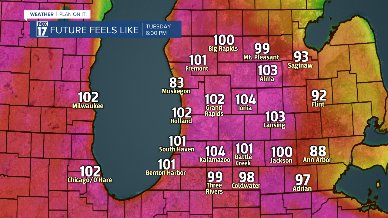
We may not see record high temperatures in the mid/upper 90s, but lower 90s are certainly likely for Michigan. That said, feels like temperatures or heat indices will approach/exceed 100 degrees! Make sure the air conditioner is working and stay hydrated. Take a look at our forecast model and heat index values for Tuesday at 6 P.M. below. This is expected to repeat on Wednesday!

Behind this system on Thursday, a few showers/storms are possible in the morning, with a cooler, drier airmass filtering in by Friday. Get the complete West Michigan forecast at www.fox17online.com/weather.


