


WEST MICHIGAN - The coldest air we've seen in six years here in West Michigan is here! Don't expect temperatures above 10 degrees until Wednesday. Significant lake effect snow and wind chills below zero are part of this Arctic blast, too.
Some folks are probably saying "it's just a Michigan winter"! But its not. The last time we had high temperatures in the single digits, you'd have to go back almost SIX YEARS to January 2019. In fact, today (Monday) has been the coldest day in Grand Rapids since January 31, 2019.

Even as cold as it has been, there was only spot in West Michigan to tie a record cold high temperature. Holland's high of 9 tied its record cold high for January 20, previously set on this day in 1963. Grand Rapids' record cold high for today was 5.
But that's only part of this story. We expect heavy lake effect snow continuing through Wednesday with a foot more possible along/west of U.S. 131. Additionally, wind chills will likely be running between -10 and -20 (perhaps -25 at times) overnight and Tuesday.
The map below shows WINTER WEATHER ADVISORIES have been posted for all of our lakeshore counties and much of the inland area a well, through 1 A.M. Wednesday. We think 4" to 10"+ of snow will fall in these areas during that time. This will be a light weight, low moisture content, powdery, dry snow with blowing and drifting creating reduced visibility.
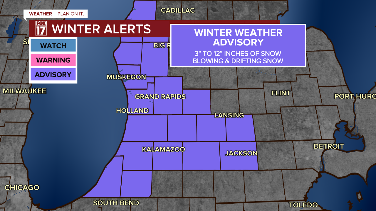
It's possible more than a foot falls up and down the Lake Michigan shoreline. See image below.

Let's talk Arctic air. The Plains, Midwest, Great Lakes, and deep south will all share in this brutally cold air mass. As the core of the Arctic air settles over the Upper Midwest and Great Lakes through tonight and tomorrow, exceptionally cold temperatures and brutal wind chills are present everywhere in the region.
For the first time since The National Weather Service has updated weather headlines, West Michigan is under a COLD WEATHER ADVISORY through Noon Wednesday.

The image below shows current temperatures at 9:30 P.M. Monday...quite cold.

The wind chill, or feels like temperature, will be anywhere from -10 to -25 degrees, too! This type of cold can cause frost bite or hypothermia within 30 minutes if not properly protected when outdoors. Make sure to take this seriously and don't forget about your pets.
Our coldest air is expected Tuesday. Even with wind not as gusty as Monday, the feels like temperature is expected to be its lowest.
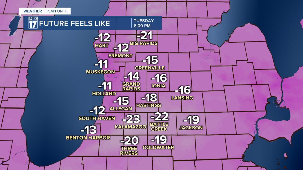
Feels like temperatures will stay very low through the day Tuesday, and may briefly fall even lower into Wednesday morning.

Wednesday afternoon starts a warming trend, but highs will stay in the teens. Even into Thursday warmer air has a hard time making it into West Michigan as a cold clipper system is expected to slide in from the Midwest, reinforcing the cold and snowy pattern.
Get the complete West Michigan forecast at www.fox17online.com/weather.