


The forecast from FOX 17 Meteorologist Kara James: Colder air sticks around this weekend with highs falling back into the 30s and additional snow showers...especially Saturday night into Sunday where 1" to 3" will be possible, mainly along/west of U.S. 131. Breezy west/northwest winds continue overnight and Saturday, with wind chills saying in the 20s all day Saturday. Bundle up! Early next week temperatures stay in the 30s, with an active pattern of quick clippers bringing snow and wintry mix chances most days. Monday will be the dryest day of the week, with the best chance for sunshine. Winter is not quite over yet!
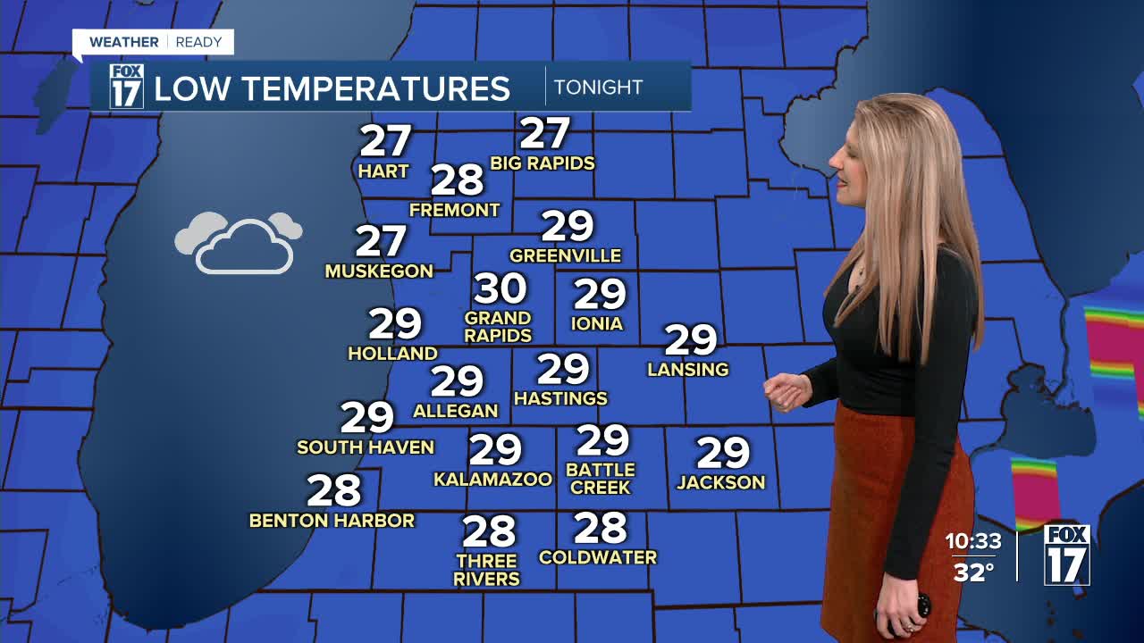
TONIGHT: Mostly cloudy and breezy with a chance of snow showers. Lows around 30. Winds: W 10 to 20 mph.
SATURDAY: Mostly cloudy and cooler. Highs in the mid-30s. Chance of P.M./nighttime snow showers. Winds: NW 10 - 20 mph
SUNDAY: Mostly cloudy with a chance of snow showers. 1" to 3" possible mainly along/west of U.S. 131. Highs in the lower 30s.
MONDAY: Partly sunny to mostly cloudy. Chance of lakeshore snow showers. Highs in the upper 20s.
TUESDAY: Mostly cloudy with snow showers. Highs in the low 30s.
WEDNESDAY: Mostly cloudy with a chance of rain/snow showers. Highs in the upper 30s.
THURSDAY: Mostly cloudy with chance snow showers. Highs in the mid 30s.
FRIDAY: Mostly cloudy. Highs in the upper 30s.
For the latest details on the weather in West Michigan, head to the FOX 17 Weather page.
Follow FOX 17: Facebook - X (formerly Twitter) - Instagram - YouTube
