


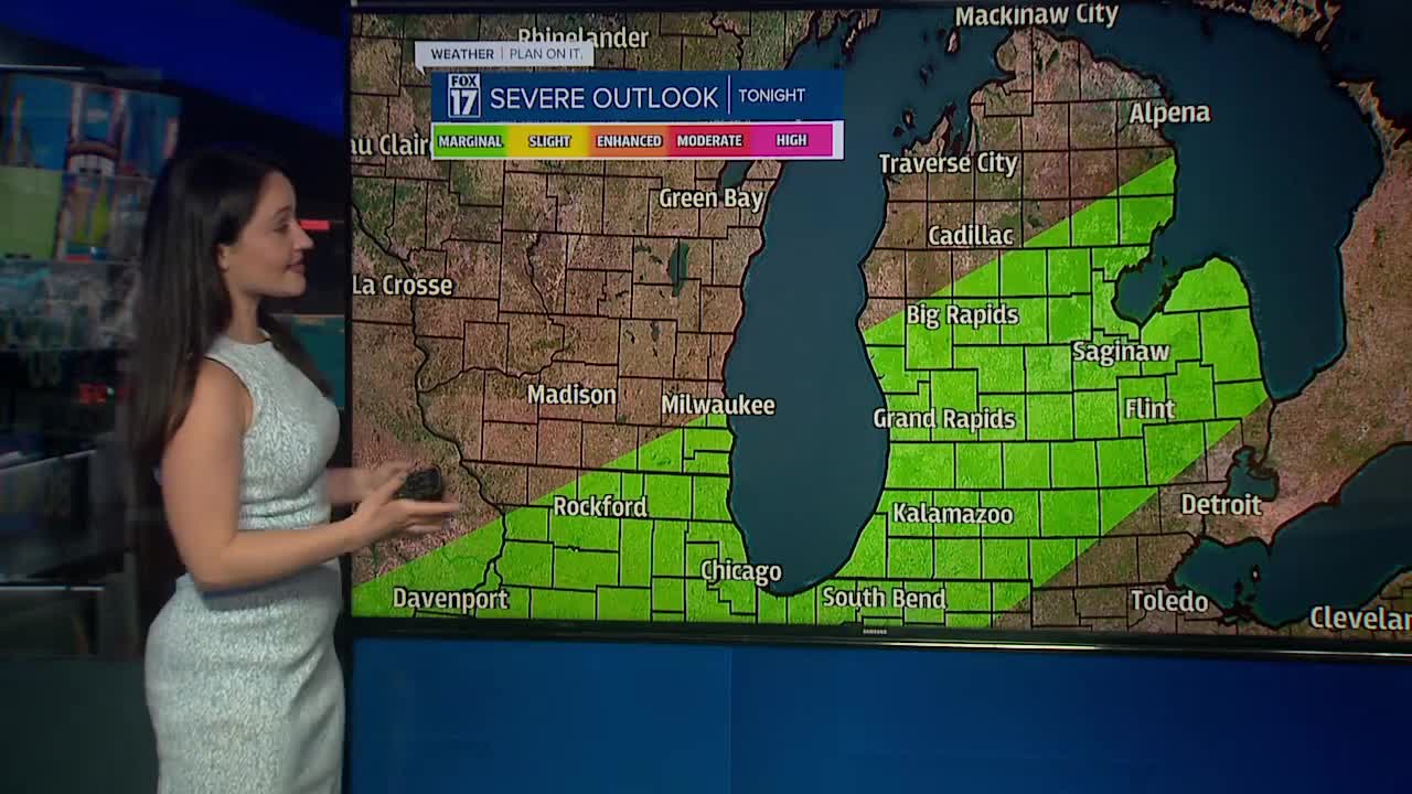

WEST MICHIGAN — The forecast from FOX 17 Meteorologist Haleigh Vaughn: A cold front is sweeping across West Michigan, firing up showers and thunderstorms. Some of these may be on the strong to severe side, with strong wind gusts and hail being the primary concerns. A few scattered showers are possible into Wednesday morning, with dry skies for the majority of your day. A few stray showers are also possible early Thursday morning, with a nice mix of sun and clouds for Thursday afternoon and evening. It's going to feel much cooler for the rest of the work week, with high temperatures mainly in the lower 70s. For the latest forecast and immediate severe weather alerts, you can always download the free FOX 17 Weather App.
TONIGHT: Cloudy with showers and storms; some storms possibly strong to severe. Lows in the low/mid 60s. Southwest/west winds 10 to 15 mph.
TOMORROW: Chance of a lingering early morning shower, otherwise becoming partly cloudy. Feeling much more comfortable, with highs in the low/mid 70s. Winds northwest/north at 5 to 15 mph.
THURSDAY: Partly sunny and seasonably cooler with highs in the upper 60s. Slight chance of a passing shower or few sprinkles.
FRIDAY: Mostly sunny. Highs in the lower 70s.
SATURDAY: Partly cloudy. Highs in the lower 70s.
For the latest details on the weather in West Michigan, head to the FOX 17 Weather page.