
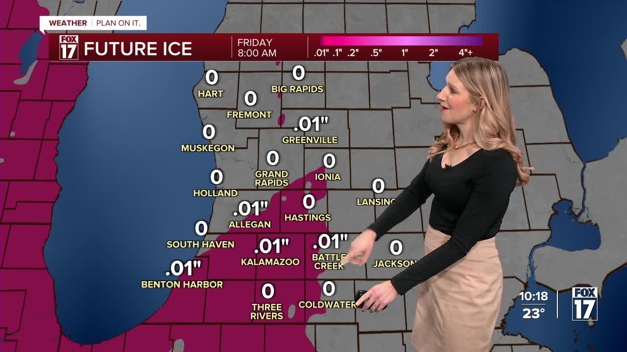


WEST MICHIGAN — From Fox 17 Weather Ready Meteorologist Kara James: A WINTER WEATHER ADVISORY is in effect until 1PM Friday, for slick travel from light freezing drizzle and low visibility due to widespread snow. A batch of freezing drizzle is possible late this evening and overnight, so expect the potential for hazardous travel conditions. Another round of widespread but heavier snow early tomorrow morning will cause slick spots for the morning commute, adding 1-2" of snow areawide. Dry air returns tomorrow afternoon. Friday's temperatures will climb into the low 30s by midday and will drop into the 20s during the afternoon. Wind chills could be as low as -5 by 4 p.m. Friday. Another Arctic blast kicks off this weekend, with Saturday morning's temperatures just a little above zero and highs in the teens. Occasional snow showers will be possible this weekend, but much of the time will remain dry. Warmer weather returns next week.
TONIGHT: WINTER WEATHER ADVISORY. Chance snow and light freezing rain. Temps hold in the 20s Winds: SW 10-15 mph
FRIDAY: WINTER WEATHER ADVISORY (Until 1PM) Blustery. Morning snow. Temperatures in the teens by mid-afternoon. Winds: W 15-25 mph
SATURDAY: Sharply colder. Partly cloudy, isolated lake effect snow showers. Highs in the upper teens.
SUNDAY: Mostly cloudy with morning snow showers. Highs in the mid-20s.
MONDAY: Mostly cloudy. Not as cold. Highs in the low-30s.
TUESDAY: Considerable cloudiness. Highs in the low 30s.
WEDNESDAY: Mostly cloudy. Highs in the low 30s.
For the latest details on the weather in West Michigan, head to the FOX 17 Weather page.
Follow FOX 17: Facebook - X (formerly Twitter) - Instagram - YouTube
