
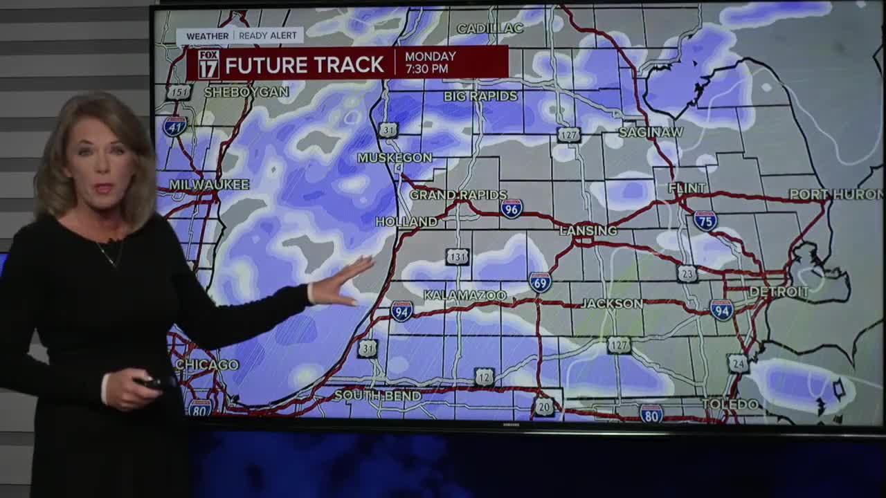


WEST MICHIGAN — From Fox 17 Weather Ready Meteorologist Terri DeBoer: A cold and icy night is ahead across West Michigan as the final lake effect snow showers finally come to an end. West Michigan spent Sunday "digging out" from a widespread round of 6 to 12 inches of snow that fell this weekend. Some area roads could remain snow-covered and slippery. With temperatures dropping into the teens, expect an icy start to Monday. Another system is on the horizon for Monday afternoon and Monday night. Widespread light snow is likely, but a bulls-eye of very heavy snow will target three lakeshore counties. Muskegon, Ottawa and Oceana counties could pick up more than a foot of additional snow from Monday afternoon through Tuesday morning. Those counties are under a WINTER STORM WATCH for the potential for significant travel disruptions. The overall pattern remains unseasonably cold and active, with several periods of snow on the horizon over the next several days.
TONIGHT: Cold and icy. Any lingering snow ending. Lows in the teens. NW 5-10 mph
MONDAY: Cold and icy morning. Lt. snow developing afternoon. Snow will be much heavier in Ottawa, Muskegon and Oceana Counties where a WINTER STORM WATCH will be in effect from Monday afternoon through Tuesday morning. Highs in the upper 20s. Winds: S 10-20 mph
TUESDAY: Cold and quiet. Any lingering snow ends early. Highs in the upper 20s.
WEDNESDAY: Cold and quiet. Few snow showers. Highs in the low 30s.
THURSDAY: Sharply colder with snow showers. Highs in the low-20s
FRIDAY: Chance few snow showers. Highs in the mid-20s.
SATURDAY: Chance snow. Highs in the low 30s.
SUNDAY: Chance few snow showers. Highs near 30-degrees.
For the latest details on the weather in West Michigan, head to the FOX 17 Weather page.
Follow FOX 17: Facebook - X (formerly Twitter) - Instagram - YouTube
