


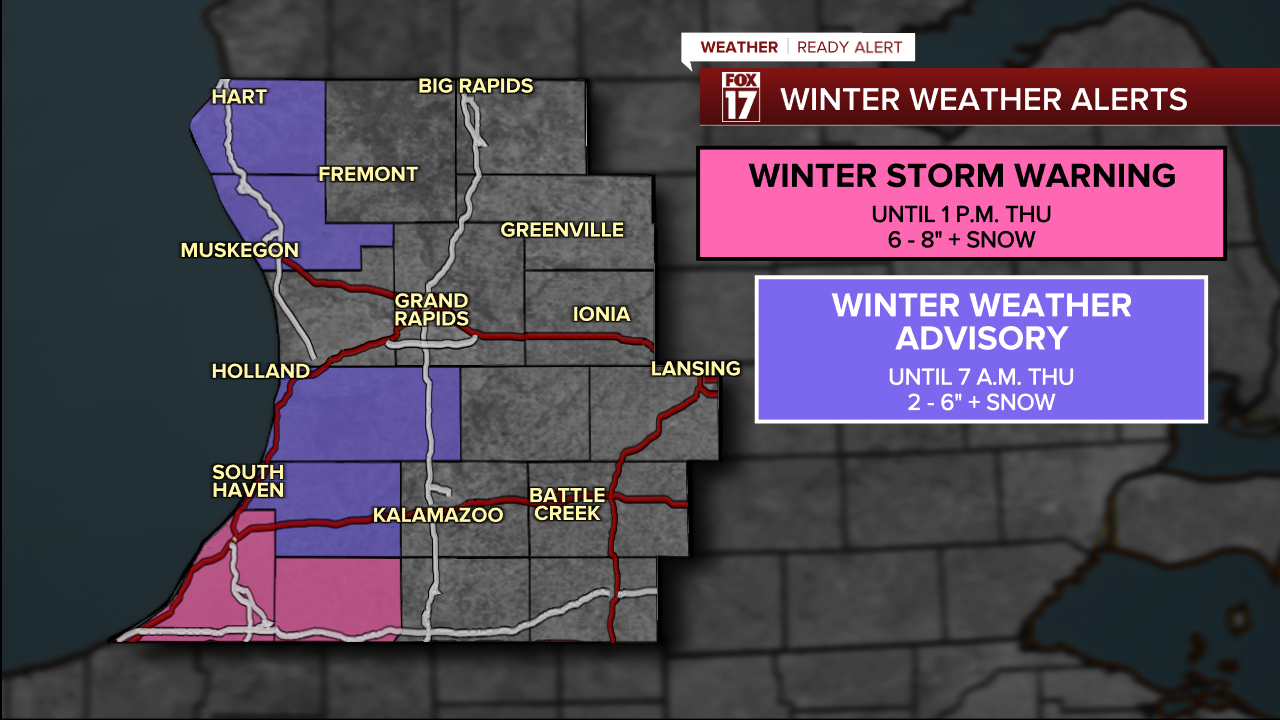
WEST MICHIGAN — From Fox 17 Weather Ready Meteorologist Kara James: Windy and sharply colder conditions have moved into West Michigan behind the first Arctic cold front of the week. Heavy lake effect snow showers are still expected tonight along the immediate lakeshore, and especially in Berrien, Cass and Van Buren Counties. A WINTER STORM WARNING is in effect for Berrien and Cass counties through noon Thursday, for the potential for as much as 6-9" of new snow! Totals will rapidly trail off away from the lakeshore. A WINTER WEATHER ADVISORY is in effect for Oceana, Muskegon, Allegan, and Van Buren Counties for 2-6" of snow and gusty winds through Thursday morning.
Thursday afternoon will dry out before another front arrives with more widespread accumulating snow. Lake effect snow showers will develop most days this week, gradually accumulating and causing slick spots on the roads and low visibility. Very cold and windy days and nights will pull wind chills down into the single digits or below zero as Arctic air continues to flow into the Great Lakes. Brr!
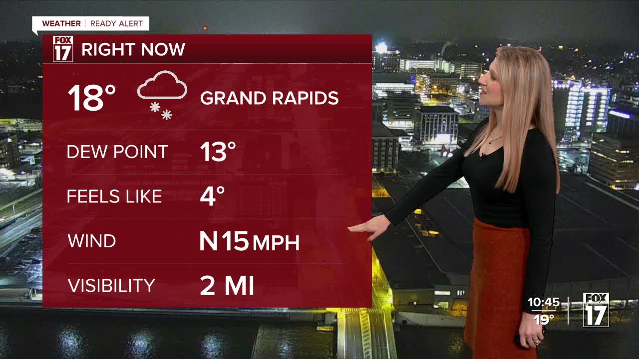
TONIGHT: Very cold and breezy. Snow showers near the lakeshore. Lows in the teens, wind chills around 5. Winds: NW 10-20 mph
THURSDAY: A WINTER STORM WARNING for Berrien and Cass counties through noon, for the potential for as much as a FOOT of new snow! A WINTER WEATHER ADVISORY for Oceana, Muskegon, Allegan, and Van Buren Counties through 7 a.m. for 2-6" of snow and gusty winds. Sharply colder. Partial sunshine. Scattered snow showers. Highs in the low-20s.
FRIDAY: Widespread snow for the morning commute. 2-4" likely. Cold with highs in the upper 20s.
SATURDAY: Cold with chance snow showers. Highs in the upper 20s.
SUNDAY: Mostly cloudy. Few flurries/snow showers. Highs in the low-20s.
MONDAY: Even colder with snow showers. Highs in the teens
TUESDAY: Cold with snow showers. Highs in the teens.
WEDNESDAY: Mostly cloudy with snow showers. Highs in the teens.
For the latest details on the weather in West Michigan, head to the FOX 17 Weather page.
Follow FOX 17: Facebook - X (formerly Twitter) - Instagram - YouTube
