


WEST MICHIGAN — West Michigan is back in the spotlight for storms. We've endured cooler air most of August, limiting the fuel for storms. But this has changed for the last week of this month. Over the next two days, we remain in a risk or threat for strong to severe storms. Hail and wind would be the primary threats.

The SLIGHT RISK is a 2 out of 5 severe weather scale, and a concern for potentially 2 rounds of storms. We had one this morning that was not severe, but another late afternoon & evening round is possible. Wind and hail are the main threats, but an isolated tornado chance is non-zero. Greatest threat for a tornado is actually in Northern Lower Michigan.

See the SPC Day 2 Wednesday outlook below. Level i out of 5 or a marginal risk, mainly south of Grand Rapids.

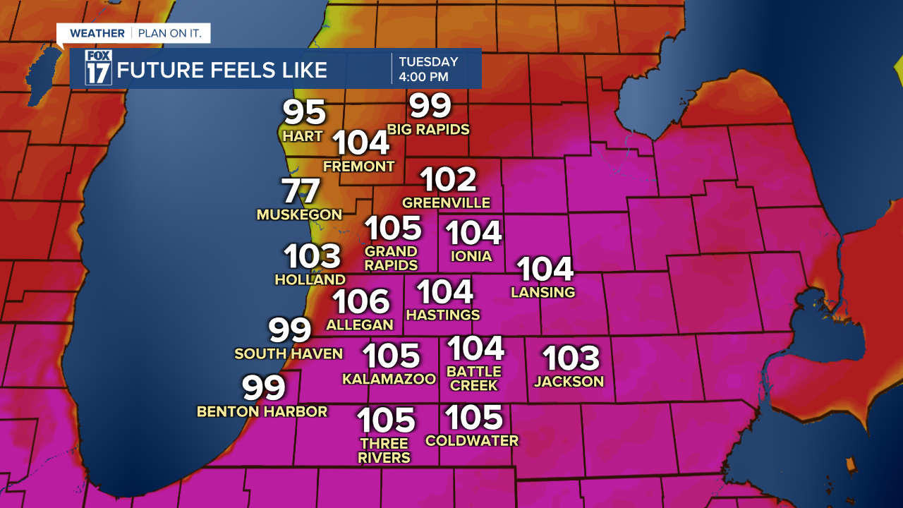
In-between any precipitation, humidity is going to be very high, with Dew Points in the low/mid 70s. This will push feels like temperatures into the triple digits with actual air temperatures in the lower 90s.

West Michigan is under a HEAT ADVISORY with index values up to 105 degrees from 10 A.M. to 10 P.M. Tuesday. Heat exhaustion may even lead to heat stroke if not taking precautionary action in this muggy atmosphere.
The Storm Prediction Center now updates the storm outlooks every 12 hours, instead of once a day, allowing for more detailed updates more often. We will keep you updated on any changes with a very unstable air mass moving in.
For the latest details on the weather in West Michigan, head to the FOX 17 Weather page.
Follow FOX 17: Facebook - X (formerly Twitter) - Instagram - YouTube
