WEST MICHIGAN - It's hard to think about Arctic air next week with the sunshine and above normal temperatures we've experienced this week. Our pattern will actually turn colder (40s) on Friday, then even colder before Thanksgiving. This Arctic air may drive some accumulating lake effect snow.
The airmass from Canada plunging into the Great Lakes, mixing with a low pressure from the Gulf of Mexico may lead to a more active weather week for the Holiday! An upper level trough, or dip in our jetstream will also be in the region, turning our weather more unsettled.
Tuesday morning, we can expect to see rain showers developing across West Michigan and most of the lower peninsula.

Notice most of the colder air remains in the U.P. and Wisconsin through Tuesday as the low pressure tracks from southwest to northeast. As the system shifts east is when we will start to see the snow potential into Wednesday.
By Wednesday at midnight, colder air is already wrapping into our area with rain mixing with and changing to snow showers (pink). It will depend on the amount of moisture we see on Tuesday, but will have to watch the potential for slick roads.
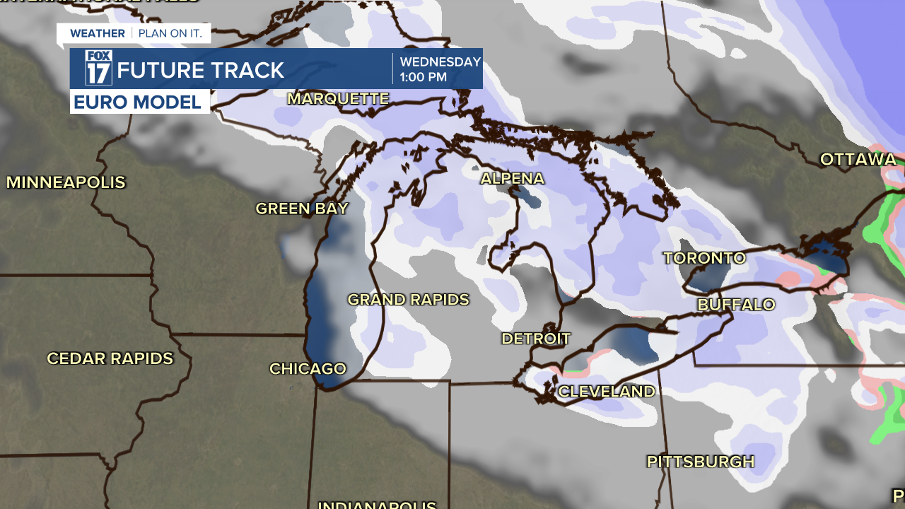
By Wednesday daytime, the cold air is pushing in and beginning to get the lake effect snow making machine going. The image below is Wednesday afternoon. Westerly winds may produce several inches of accumulation, at least the possibility is there. The ample moisture to produce the snow remains in question, however.

Westerly, or west-northwesterly winds will drag the snow inland to locations east of U.S. 131 as well. Models have cut back in the last 24 hours on the total moisture, leading to lighter accumulations overall in the forecast. However, the cooler air still seems more possible than any significant snow system. Make sure to stay up on later forecast, as this could impact holiday travel plans around the immediate area.
Get more at www.fox17online.com/weather.


