
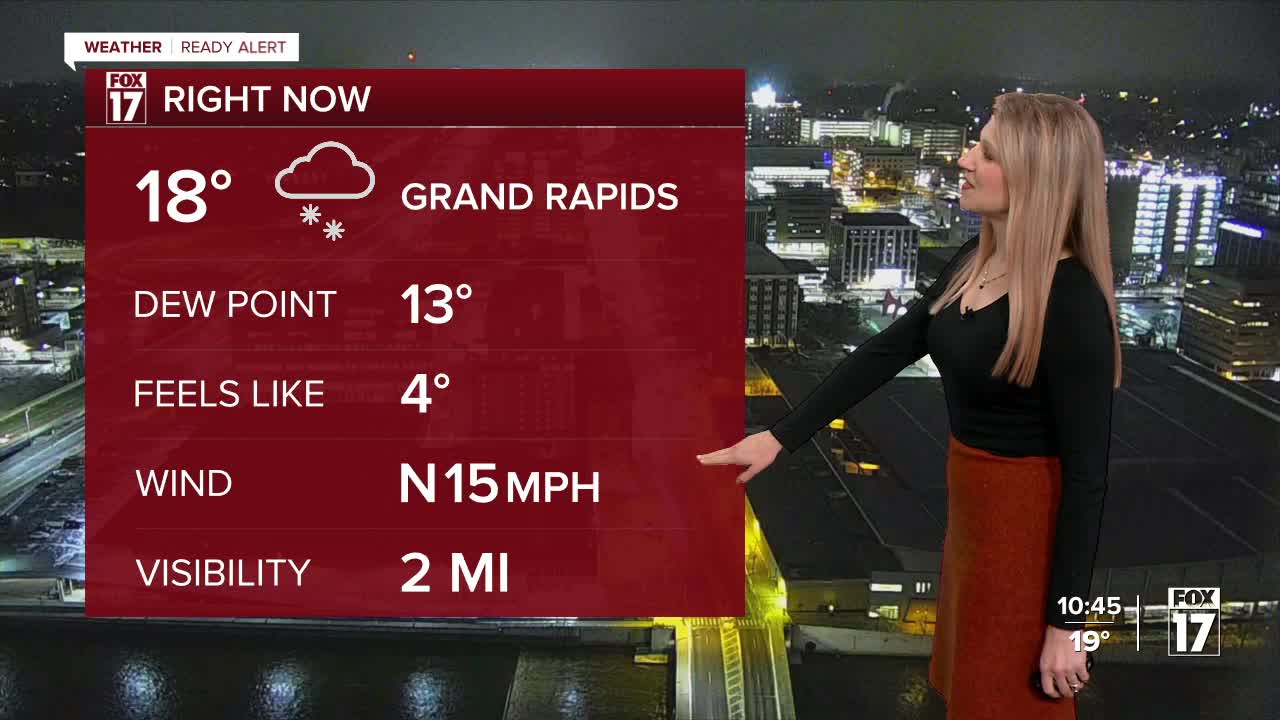


WEST MICHIGAN — After 9 straight days of above-average temperatures, Winter roared back in to West Michigan with a big punch of Arctic air, strong winds and bands of heavy lake effect snow. Fox17 meteorologists have issued a WEATHER READY ALERT for today due to sharply colder air settling into the region with heavy lake effect snow, gusty winds, blowing snow, low visibility, and slick roads.
A WINTER STORM WARNING continues for Berrien and Cass counties until 1 p.m. Thursday (pink) for heavy accumulating snow and gusty winds. A WINTER WEATHER ADVISORY continues until 7 a.m. for Oceana and Mason counties. Snow totals in the advisory area will be in the 4-6" range, but slick roads and travel impacts are still expected.
During the late evening and overnight, the lake effect band is still going strong across extreme southwest lower Michigan. Bertrand, in Berrien County, reported 10" of snow from this lake effect band Wednesday evening.. Major accumulations and travel disruptions will be happening along the lakeshore within this band.
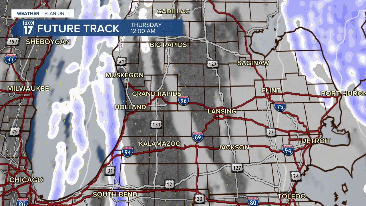
Other less intense lake effect bands will produce occasional bursts of heavy snow for inland areas, but should not impact travel.
By Thursday morning, the band will be starting to shift slightly with a wind direction change, but ongoing snow along the immediate lakeshore will still be an issue.
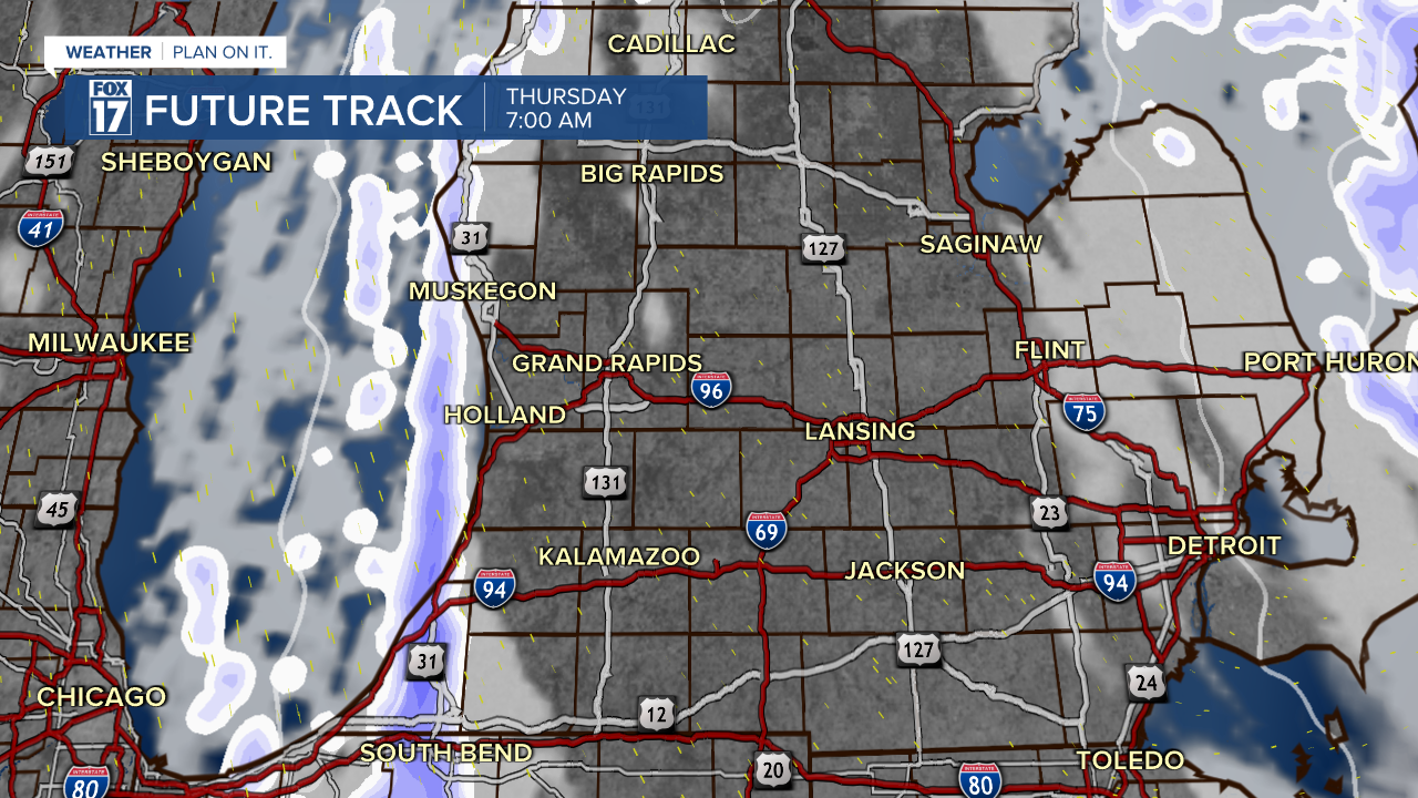
Through Thursday afternoon, the snow band will weaken and eventually fade away. Many outside of the immediate lakeshore will stay dry on Thursday.
Snow totals could be upwards of 4-6" with isolated higher totals from South Haven back through Berrien County of 10" (or more).
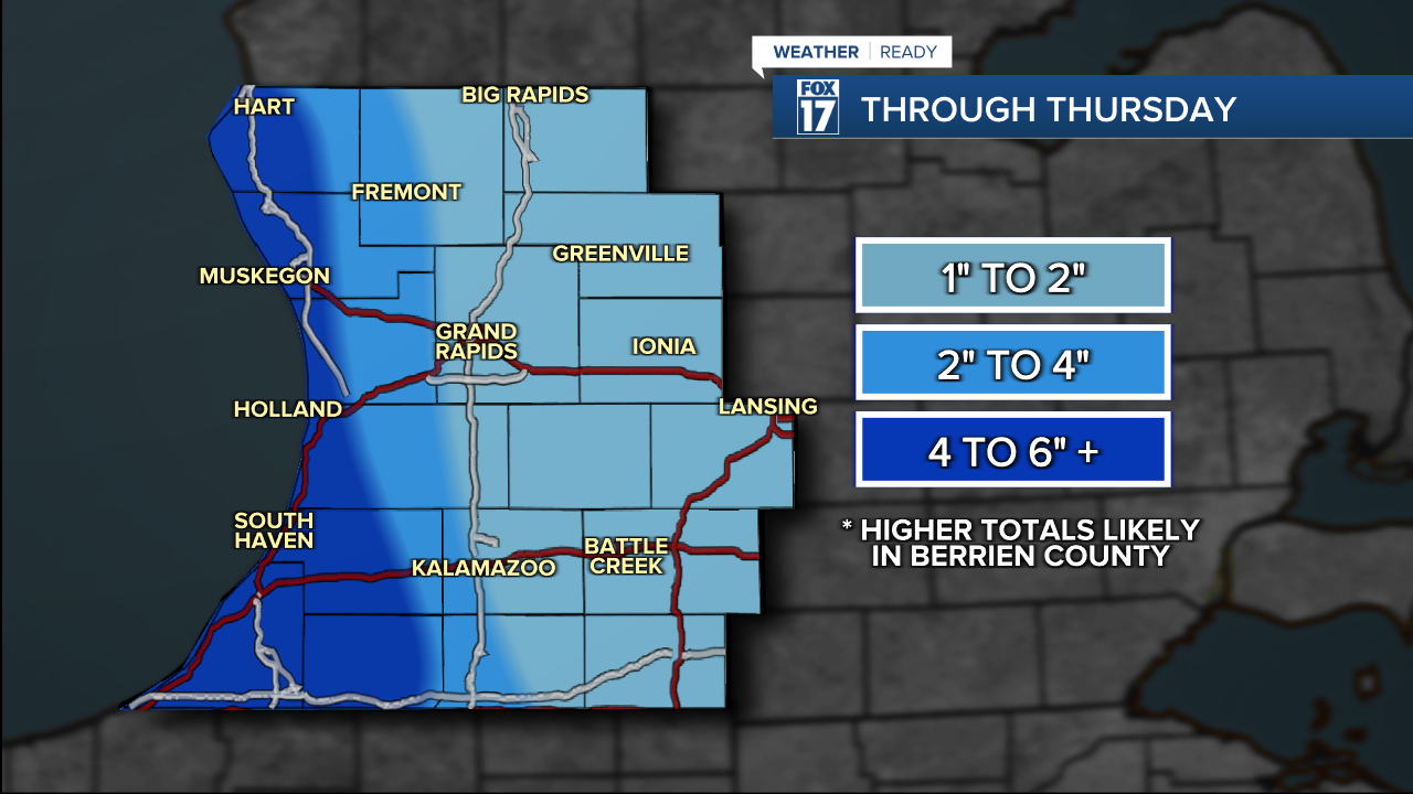
Minor travel impacts are expected along and east of 131 Thursday, but winds gusting to 30 mph at times will make wind chills in the single digits throughout much of Wednesday and Thursday. Along the lakeshore where the heaviest snow has fallen, significant travel issues will persist into Thursday.
A major pattern shift will have the Great Lakes region locked in the deep freeze through the weekend as multiple rounds of Arctic air slide south.
A round of even colder air arrives into next week, with highs expected to stay in the teens and lows in single digits, with wind chills below 0 at times.
Here's a look at the upper-level winds projected for Saturday

Several rounds of snow are likely to develop in this very cold air flow from Friday through the weekend. Areas within 10-20 miles of Lake Michigan are likely to receive at least a FOOT of snow overall.
For the latest details on the weather in West Michigan, head to the FOX 17 Weather page.
Follow FOX 17: Facebook - X (formerly Twitter) - Instagram - YouTube
