WEST MICHIGAN — The earliest Category Five Hurricane to ever form in the Atlantic basin now has its sights set on Michigan! Hurricane Beryl, that tore through the Caribbean and decimated some of the tropical islands, then moved into Southeast Texas, is now tracking our way. While it will NOT be a hurricane or tropical system, it will pack some wind and plenty of soaking rain.
A FLOOD WATCH remains in effect through Wednesday evening across most of our area. See image below.
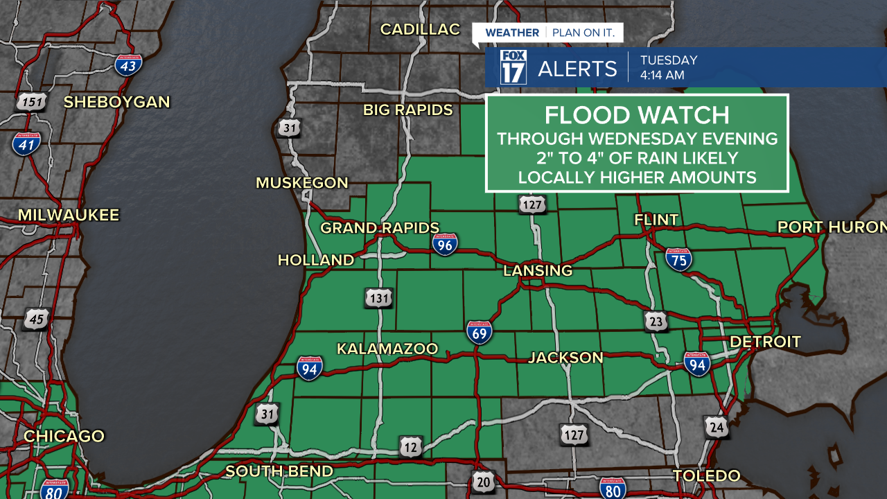
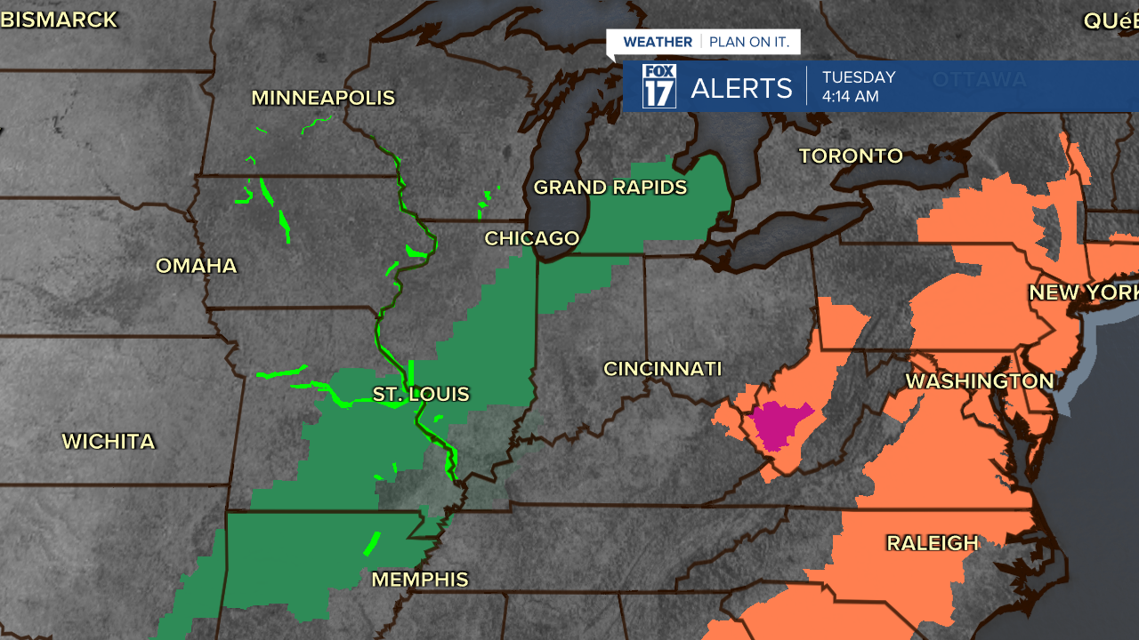
Take a look at the FLOOD WATCHES (below) that extend all the way into Arkansas from this system. It's a wide swath of moderate to heavy rain that Beryl continues to produce. The counties along the East Coast shaded in orange are HEAT ADVISORIES.
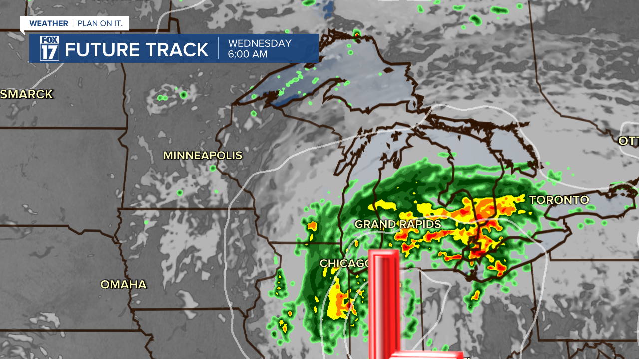
If we look at the track of Beryl, our Future Track shows the center of circulation coming up from the south and west. See image below. Notice the yellows and reds south/east of Grand Rapids, those are heavier pockets of rain.
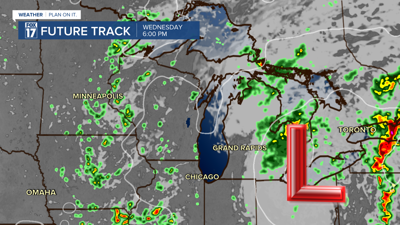
The next image below is valid for 6 PM Wednesday. The system is already pulling away into Canada.
Wind speeds are expected to ramp up a bit as this system approaches. Northeast winds at 10 to 20 mph are expected, a far cry from what this system produced in the Caribbean and over Texas.
We expect Grand Rapids to see slightly under 2" of rain, with Kalamazoo seeing upwards of 4", with isolated communities totaling 5"+.
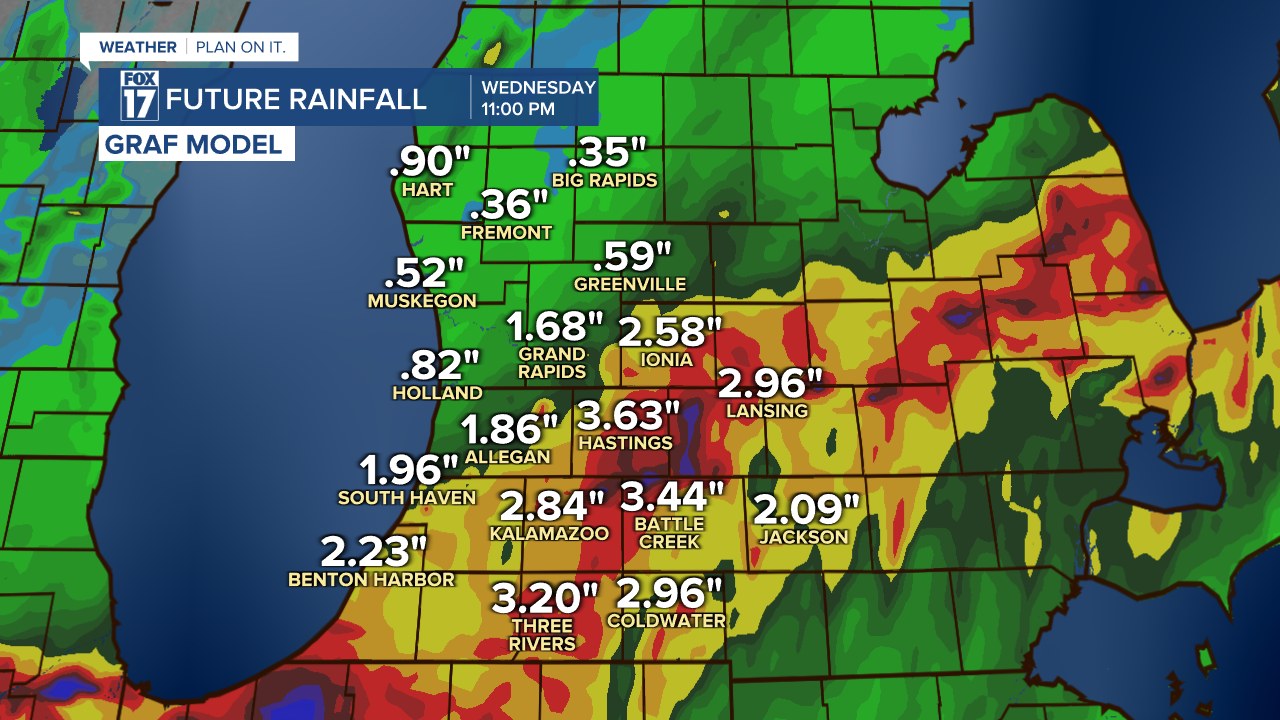
It's important not to get caught up in the EXACT amounts, but rather the trend, which clearly shows multiple-inch totals across the area from Grand rapids to the south. North of Grand Rapids will see less than an inch. Make sure to stay up on later forecast as this event unfolds. The good news? No severe weather is likely.
Get the complete West Michigan forecast at www.fox17online.com/weather.


