
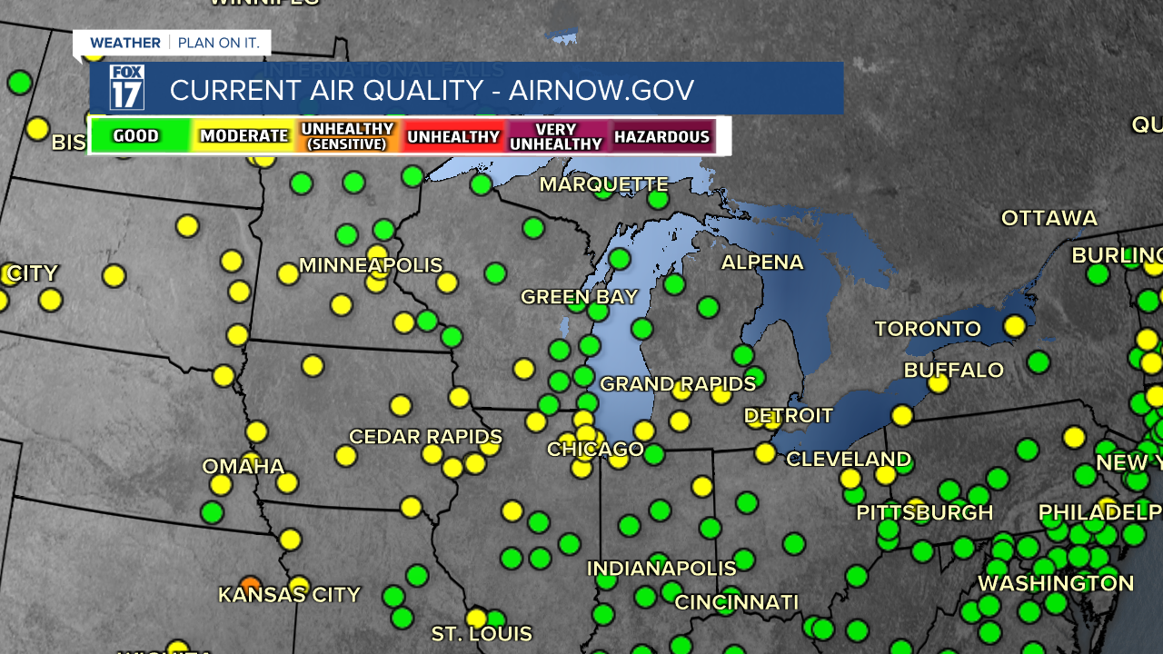


WEST MICHIGAN - A handful of Canadian wildfires burning to our north and west across a few of those Provinces our already sending smoke into the northern United States and Upper Midwest. The image attached to this story shows the current Air Quality Index or AQI across the Great Lakes and Midwest. Lots of green and yellow...both of which are not triggering advisories or alerts! Higher levels of particulate matter are already showing up in some of these areas, but air quality is still pretty good. Nothing has been posted for West Michigan.
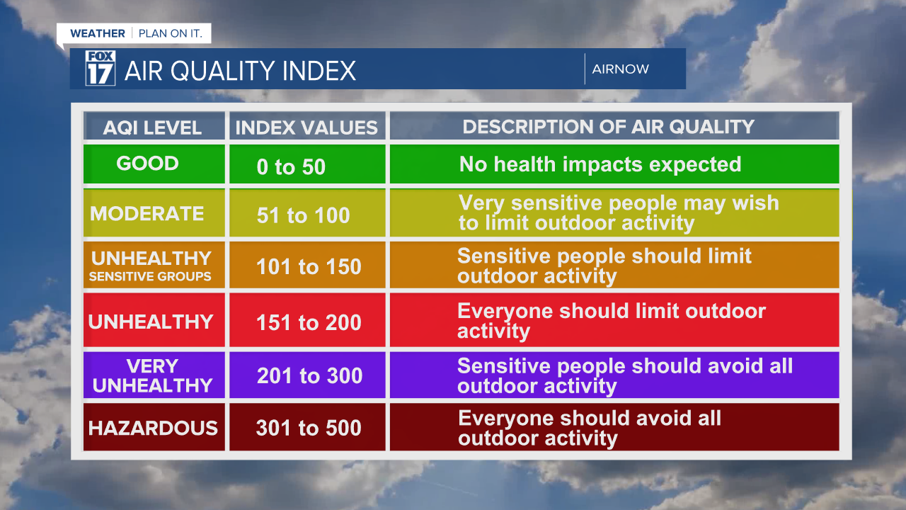
Air quality advisories are issued here when the category goes to orange or unhealthy for sensitive groups. See information legend below.
You may recall last year that a large portion of the Eastern half of the nation, including the Great Lakes, Northeast, and Mid-Atlantic had air quality issues from thick Canadian wildfire smoke for several days in the summer. While the extent of the Canadian fires are not nearly as bad as they were last year (yet), some higher concentrations of smoke are already showing up to our west. The passage of a cold front on Tuesday with a northerly flow of air could bring smaller concentrations of smoke into Michigan this week. It's not known exactly how thick it could be, but we expect any smoke and particulate matter to thin as it arrives in our state.

Forecast models are showing at least the possibility of some of this smoke or haze making into Michigan Wednesday and Thursday. Small amounts could be near the surface, while some may be aloft and perhaps less noticeable. There are no alerts or advisories in effect for West Michigan at this time, but it's something our team of Meteorologists will continue to monitor, especially due to the effects and extent of the smoke in the summer of 2023.
Take a look at the active fires on the map below. Only the fire or flame icons are active...not the red dots.

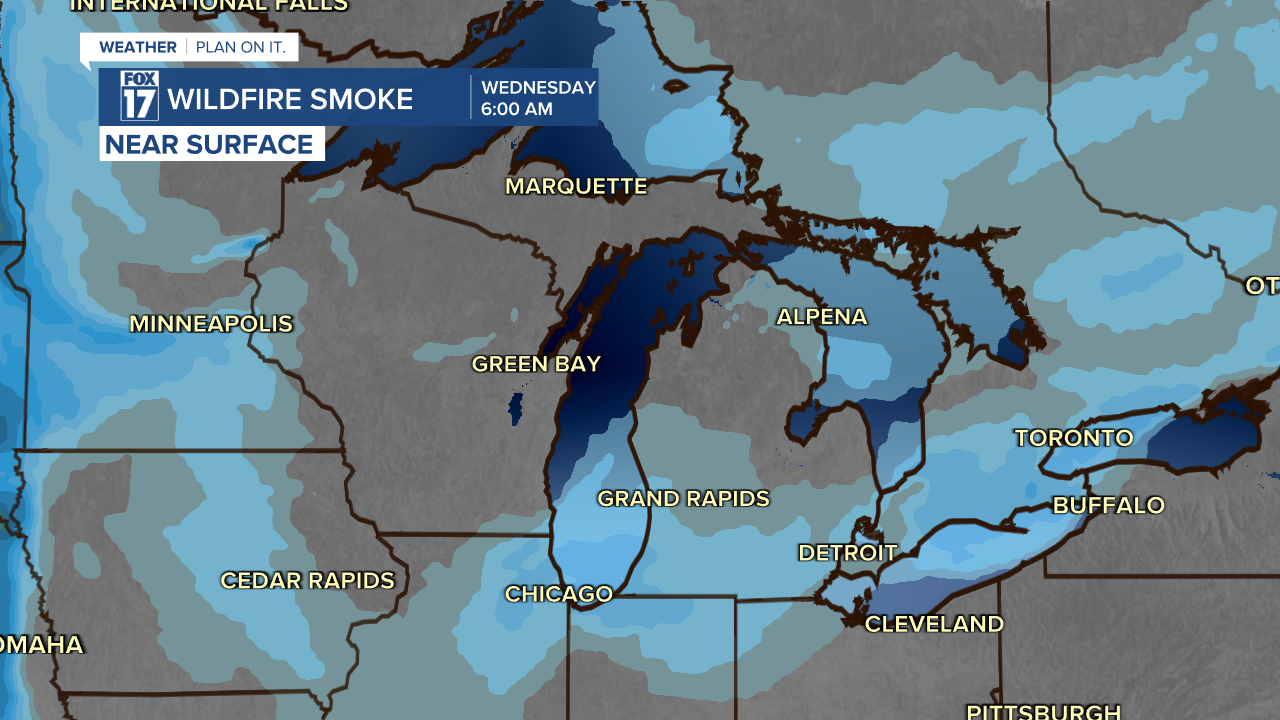
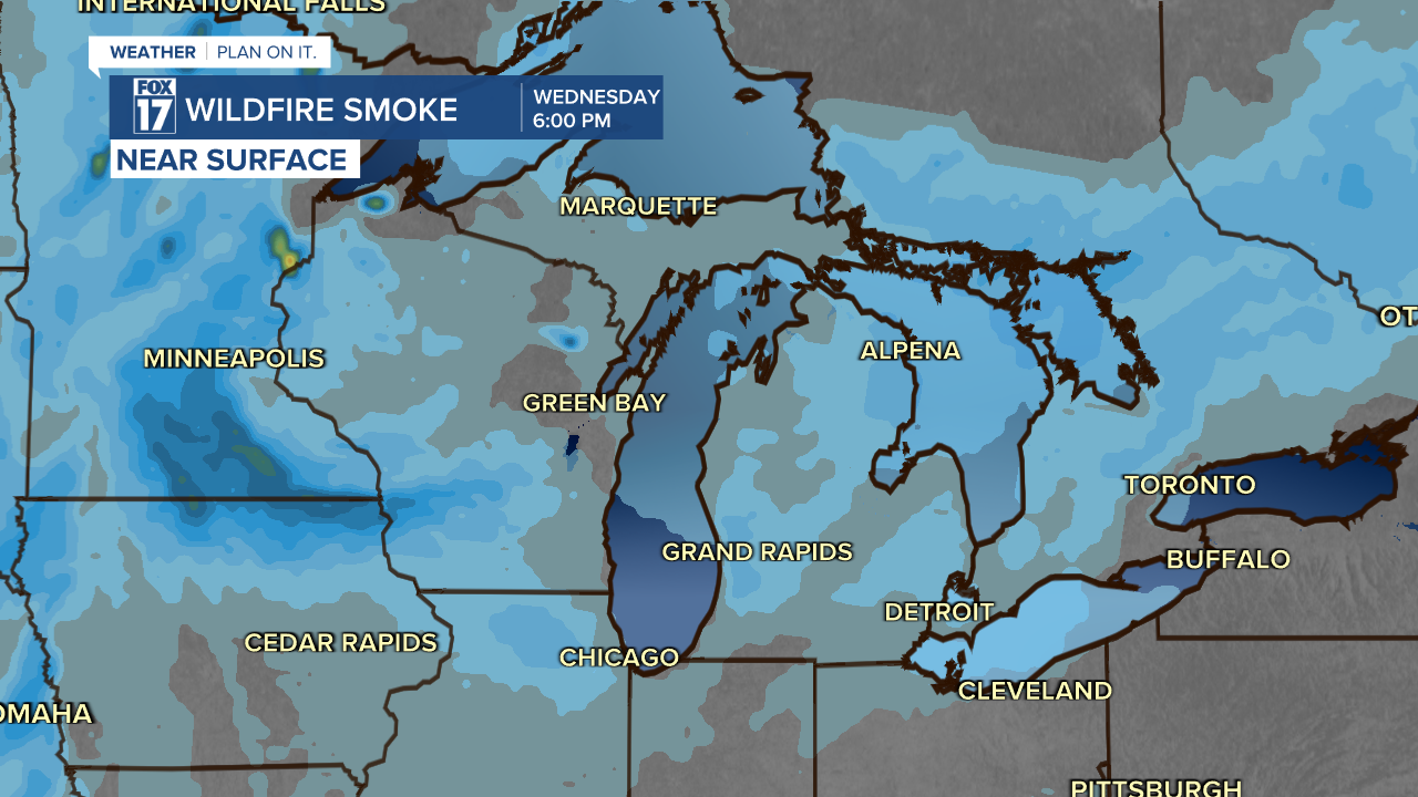
Our forecast model below shows several images over the next 24 to 36 hours illustrating that some smoke is possible over our area. It's important to note that these are just forecast models and not necessarily reality. Nonetheless, some smoke is possible according to these models. The blue colors show the smoke. The green and yellow colors (outside of our area) show the higher concentrations. See images below.
Smoke model 6 AM Wednesday below.
Smoke model below. Valid 6 PM Wednesday.
We will continue to monitor the Air Quality Index and and progression of the smoke over the next several days. You can get more here.
Get the FOX 17 forecast at www.fox17online.com/weather.