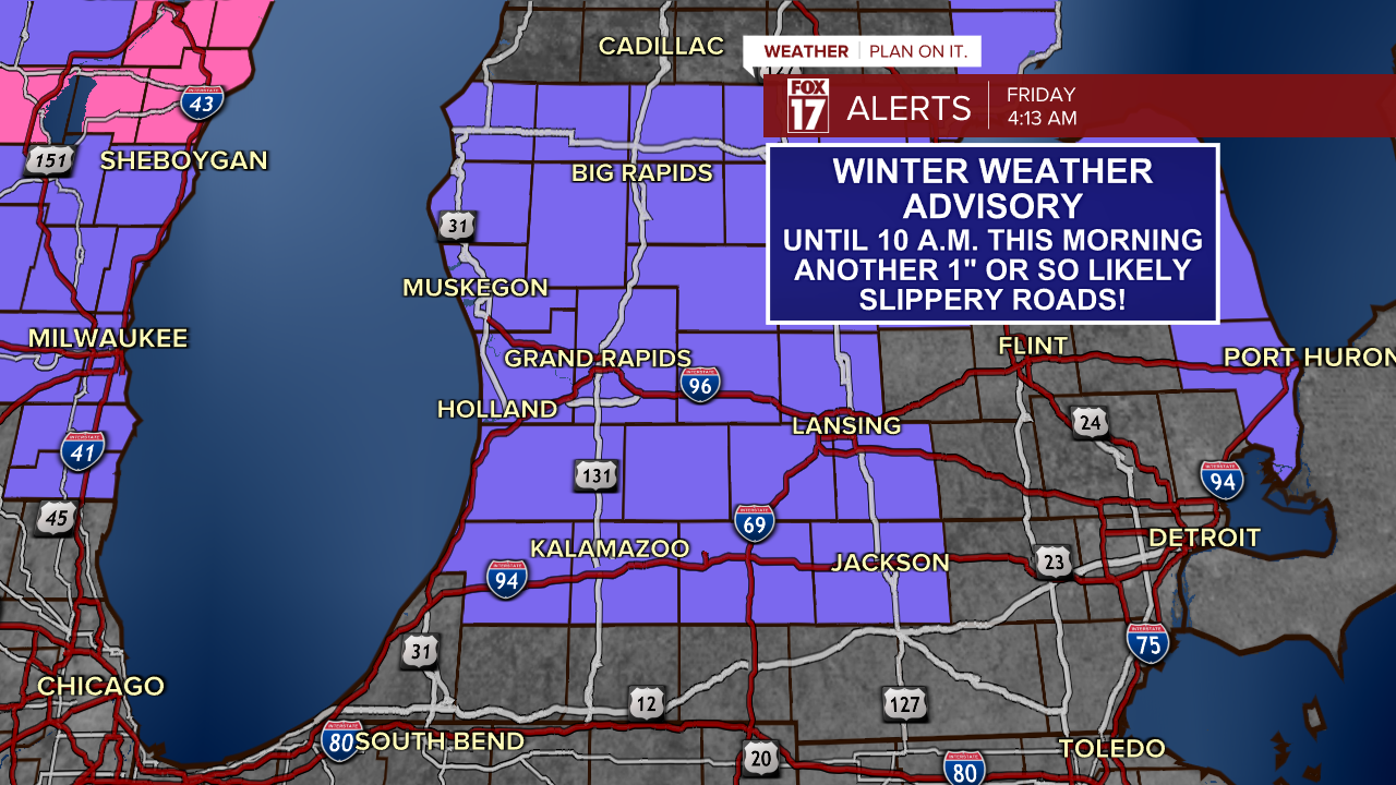
After almost all of the snow we received over the last month melted, this clipper system is bringing a fresh coat of snow to West Michigan.
This clipper system brings consistent and widespread light snow with it through around noon today. The initial round of snow Thursday afternoon melted on contact and then re-froze, leaving roads with a layer of ice underneath the snow.
See our winter weather alerts for the area below, in place through 10 AM Friday. Impacts from the snow will stretch across all of West Michigan, not just the advisory area.

This early burst of snow Thursday afternoon resulted in about an inch of snow north of I-94. Consistent light and widespread snow will be the rule through much of the evening and overnight as the center of the clipper system moves to our south.
The morning commute will be impacted by accumulating snow overnight and new falling snow. Even as snow stops falling, it will take awhile to get the road conditions to improve.

By early afternoon as the low center moves into the Ohio Valley, snow will come to an end. Light snow wrapping around the back side of the low is possible through the late afternoon, but most of the accumulating snow will be ending around noon, or even earlier in some cases.

Snow totals will be generally 2" to 5" across the area. See the expected impacts below.

Conditions will improve significantly into this afternoon, with highs around freezing areawide. However, in the afternoon it will become breezy and feels like temperatures will be in the 20s.
Stay with FOX 17 for the latest updates on this next snowy system!


