


WEST MICHIGAN — More Winter weather is here! No signs of Spring in the 7 day forecast.
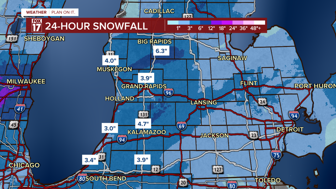
The Winter Weather Advisory continues through Thursday morning, although snow is gradually tapering down now that the center of the low is moving away. Snow totals are likely to be in the 4" to 6" range, with isolated higher totals up to 7" possible.

As of Wednesday night, radar estimates a widespread 3-5" of snow has already fallen with another inch or two possible through Thursday.
Expect difficult travel to continue from blowing and drifting snow even as snow ends.
THE BREAKDOWN:
The heaviest snow overnight transitions into the east side of the state. By 6 AM Thursday morning, most of the synoptic or system snow will be lifting out of the state. See our projected travel conditions map below.
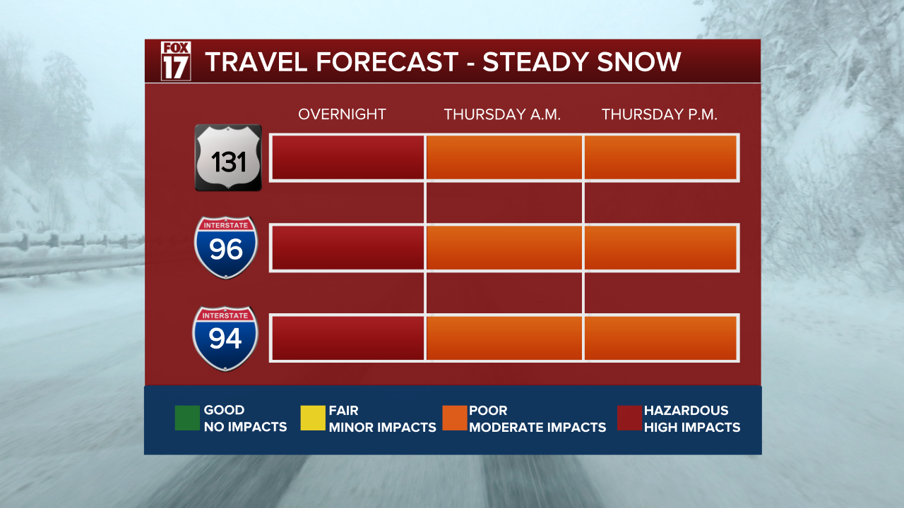
We may see some lingering light lake effect snow showers on Thursday morning into midday, but a focus will turn to blowing and drifting snow potential with wind gusts from 25 to 30 mph Thursday.

After this system exits, we will be watching another potential system arriving late Friday into Saturday.

Stay up with the FOX 17 Weather Team for updates as this system continues to evolve.
Follow FOX 17: Facebook - X (formerly Twitter) - Instagram - YouTube