


WEST MICHIGAN — Last week was a comfortable week with low humidity and dry air. Heat, humidity, and thunderstorm are the story for this week, though.
First, wildfire smoke from West Coast fires may move into the Great Lakes the next few days and give us a milky white sky. It is not expected to reach the lower levels of the atmosphere or impact our air quality.
While it won't be raining all of the time, we have more shower and storm chances on Monday and Tuesday as a low pressure system and cold front move through the region on those days. See images below.
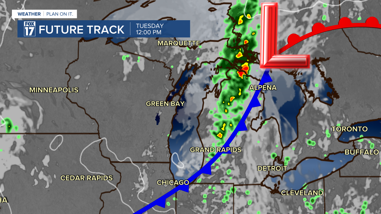
Once this system moves east, we expect dry conditions on Wednesday, with more shower/storm chances Thursday and Friday. At this time, we are in a MARGINAL RISK (level 1 of 5) for strong to severe storms today, tonight, tomorrow, and Wednesday night. Hail and wind are the primary threats, with moderate to heavy rain possible due to all the moisture in the air. See the outlook for each day below issued by the Storm Prediction Center.


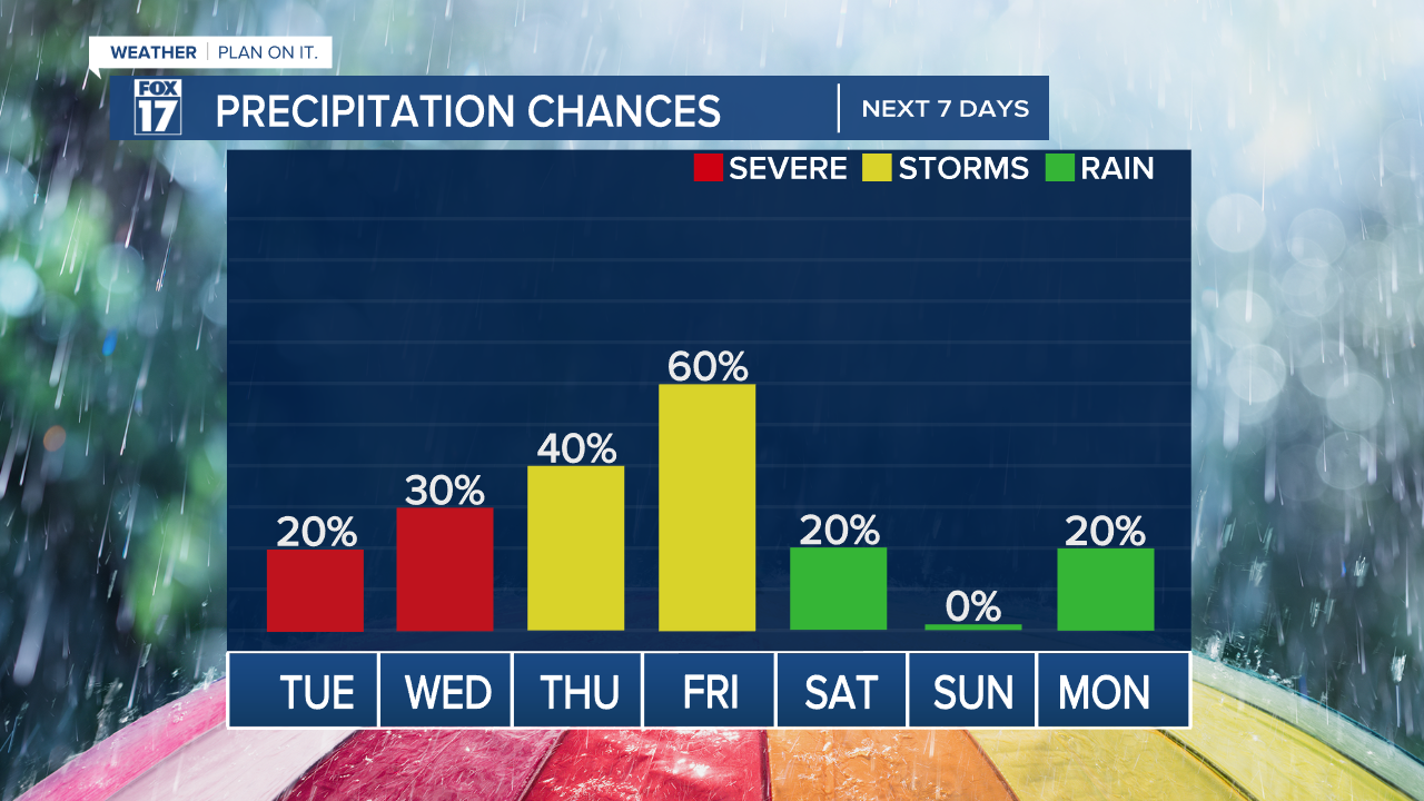
Take a look at our precipitation chances below this week.
Get the complete West Michigan forecast at www.fox17online.com/weather.
