


WEST MICHIGAN — The next 24-hours will feature a couple of "firsts" for West Michigan's weather in 2025. During the daylight hours, many inland areas are likely to experience the first 70-degree day of 2025. After midnight, a line of strong thunderstorms will march through the region; creating the potential for the first severe thunderstorms of the season!
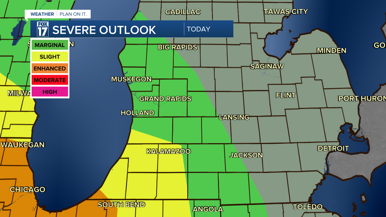
The most likely areas to experience severe weather will be south of Grand Rapids; along and south of a line through central Allegan County. These storms will have the potential to create damaging winds and locally heavy rainfall. The chance for an isolated tornado isn't zero, but it is small.

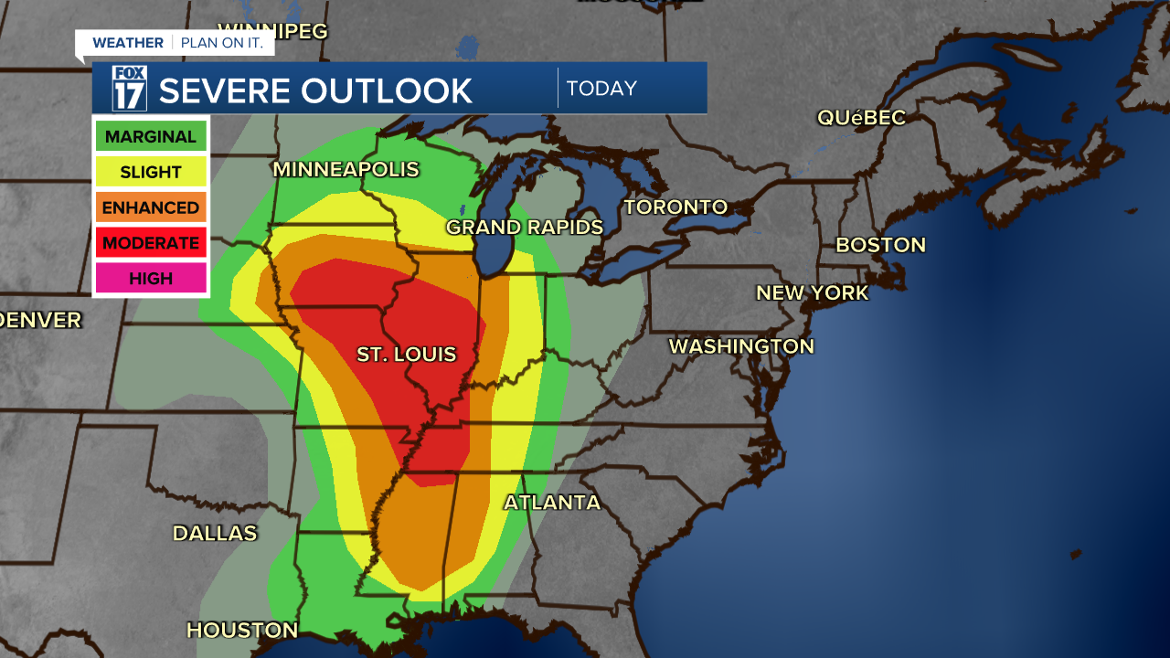
This is a strong storm system that will bring the potential for strong to severe thunderstorms from Lake Superior all the way south to the Gulf Coast. The best chance for severe weather will stay to the southwest of Michigan, primarily from Chicago back through Iowa into Eastern Nebraska, into Missouri, Western Kentucky and Tennessee. Areas on this wide map from the Storm Prediction Center will show the most favorable locations for severe weather in the red-shaded areas; where an outbreak of supercell tornadoes will be possible today. If you are traveling through those states, be sure to tune into a local media outlet that offers LIVE weather reports.
Follow FOX 17: Facebook - X (formerly Twitter) - Instagram - YouTube