


WEST MICHIGAN — As we continue to build heat and humidity today, we will also increase the chance of showers and thunderstorms, some of which may be strong to severe this evening and overnight. This article will outline the threats and timing.
With humidity high all Monday, a warm air mass overhead, and a cooler air mass sliding across the region tonight, we are in the sweet spot to see strong storms, and even a tornado. Here is the TORNADO WATCH for West Michigan until early Tuesday.

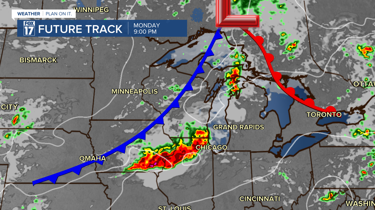
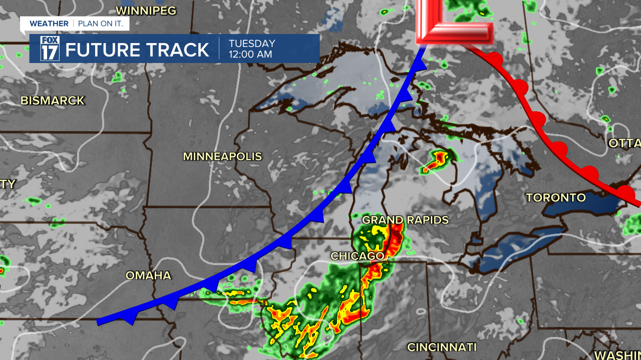
Regardless of a tornado, storms are expected to produce heavy, sometimes torrential, rainfall with all the water vapor and moisture in the atmosphere. At this time, we believe the best chance for strong/severe storms will be this evening from around 11 P.M. through about 2 A.M. Tuesday. Take a look below at our forecast model showing these time frames.
Per the Storm Prediction Center, most remain under an ENHANCED RISK OR Level 3 of 5 in orange, and/or a SLIGHT RISK or level 2 of 5 in yellow for severe storms this evening and overnight. See image below.

With highs in the upper 80s and a heat index that feels like lower 90s, the ingredients are in place for more strong/severe storms starting Monday afternoon and evening.
Get the complete forecast at www.fox7online.com/weather.
