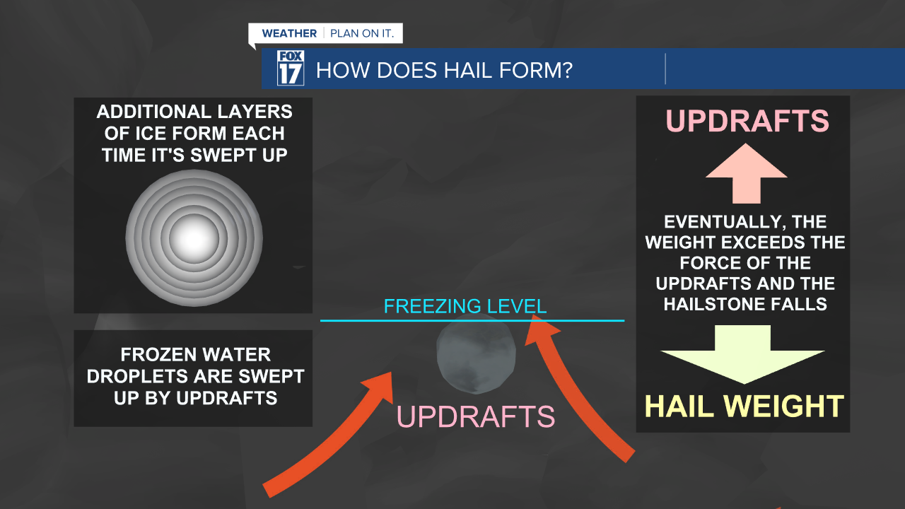
WEST MICHIGAN — We all know that hail is often associated with severe thunderstorms, but do you know how it is formed? Thunderstorms are formed with three basic concepts: moisture, lift, and instability. When thunderstorms develop, there is unstable air that creates upward movement, which is called an updraft. In addition to the upward motion, there is also a downward one, called a downdraft.
A key element of a thunderstorm is moisture! Water droplets are associated with thunderstorms and are often lifted up into the atmosphere from the updraft. These water droplets become frozen, as they rise above the freezing level. Temperatures get cooler and cooler with height in the atmosphere.

Additional layers of ice from around the water droplet as the updraft continues to drive the droplet upward, eventually becoming too heavy. The weight of the now frozen water droplet exceeds the force of the updraft and falls to the ground as hail.

Hail falls in all different sizes, depending on the strength of the storm's updraft and the longevity of the storm. Sizes can range from as small as a pea at a quarter of an inch, all the way up to the size of a grapefruit at 4.5 inches in diameter. Hail can cause damage at the size of a quarter of an inch in diameter or larger, which is also the threshold for a severe thunderstorm warning. A thunderstorm is additionally classified as severe when it has wind gusts exceeding 58 mph.

As we get closer to the severe weather season, stay tuned with FOX 17. It's best to be prepared ahead of the storms! Download the FOX 17 Weather App for immediate severe weather alerts.


