WEST MICHIGAN — While the severe weather potential for Sunday is squashed, West Michigan is still likely to be soggy with scattered rain showers!
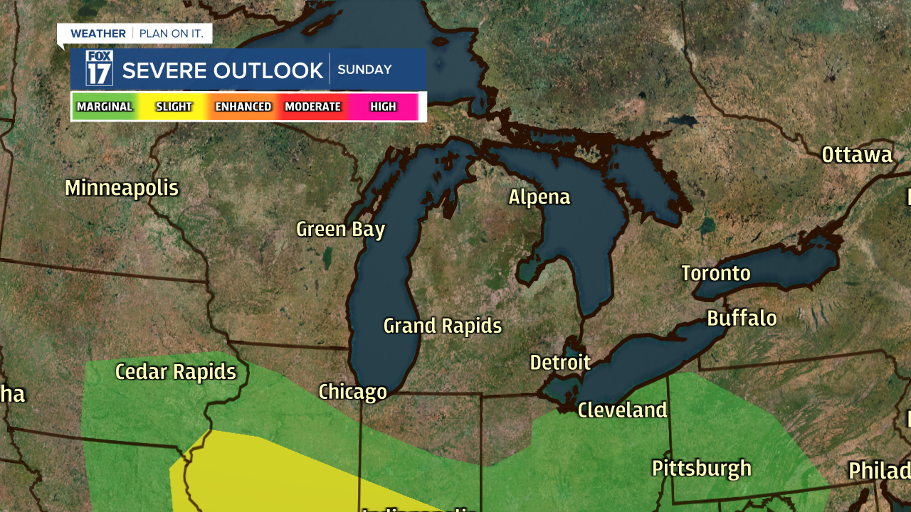
Earlier this week, forecast models were indicating severe storms on Sunday in West Michigan. Our weather pattern has shifted, and the strongest part of the storm is likely to track through Illinois and Indiana now. Below is the latest severe weather outlook from the Storm Prediction Center.

West Michigan originally fell under a SLIGHT RISK for severe storms on Sunday (a level 2 out of 5), however we are now out of the severe weather potential all together. While the strongest part of the storm will be south of Michigan, we will still see rain and a few rumbles of thunder!
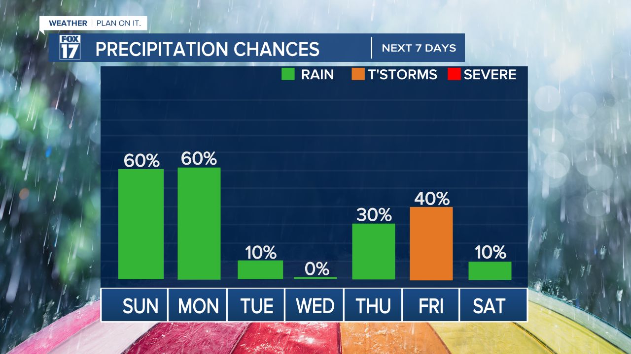
Showers are expected to develop in West Michigan Saturday night. This slow-moving system will bring scattered showers through Sunday and Monday, in addition to cooler temperatures and a good breeze.

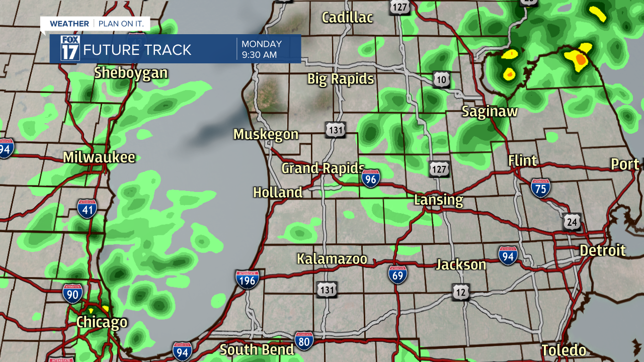
Steady rain will slowly progress from the south towards the north overnight Saturday into Sunday, eventually meeting the I-96 corridor around 5 a.m. Sunday.

Rain will persist through the day, with heavy downpours possible at times.

Our latest forecast models suggest that the heaviest rain will be in the late afternoon and evening.

Rain will become hit-or-miss on Monday, with cooler temperatures and cloudy skies lingering. High temperatures on Sunday and Monday will only reach the lower 70s, which is well-below average for this time of year.
Most locations in West Michigan will pick up 1" of rain accumulation between Sunday and Monday, with some locations receiving up to 2" of rain. This will provide a good soaking for our crops, gardens, and lawns. No need to run the sprinkler! The heaviest accumulation will be along and south of I-96.

Warmer temperatures are likely to return by Tuesday and Wednesday, along with dry skies. The next round of showers and thunderstorms that we're watching is for Thursday and Friday.
Stay tuned with FOX 17 News on air and online for your latest forecast. Looking for a LIVE radar? Click here.
Follow FOX 17: Facebook - Twitter - Instagram - YouTube


