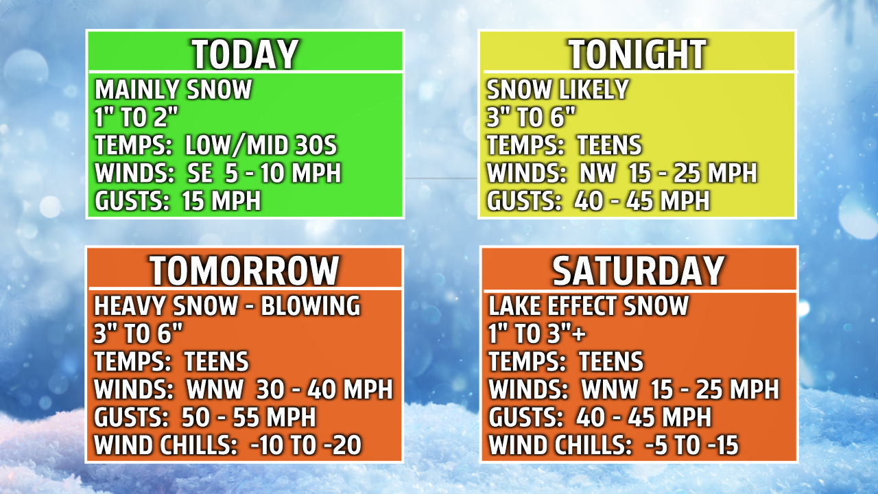
GRAND RAPIDS — Our winter storm will start to develop today as we break down the timeline for everything. Today during the day snow will be developing. We can see 1-2” of accumulations at first as the snow will be more of a heavy wet consistency with possible mixing the more southeast you travel towards the east side of the state. This evening we begin to increase our winds gusting 40-50 mph with the snow continuing gaining another 3 to 6 inches. Friday all day colder temperatures will have settled in with daytime highs in the teens feeling below zero as wind gusts will pick up even more to 50-55 mph. Widespread snow will be around all day gaining 3 to 6 inches of a more fluffy consistency making blowing and drifting snow greatly reducing visibility. Saturday lake effect snow turns on giving us an additional 1 to 3 inches of snow plus possibly more for those in our lake effect bands and along the lakeshore while our winds stay high as temperature remain in the teens feeling below zero.

Every part of this storm needs to be taken seriously especially the temperatures with how they will feel in terms of windchill. Below is the NWS wind chill chart. When we have temperatures in the teens and we factor in the winds around 50 mph we get our feel like temperatures at -10 which puts us at getting frostbite within 30 minutes. This is why doctors at Corewell Health our reminding everyone to be prepared if you head outside and dress appropriately.

"But the most important thing that people can do to prevent any sort of hypothermia or cold exposure injury is to one stay dry. And to dress in layers, and enough layers. If something freezes to the point where you can no longer feel it at all, and you lose all sensation you absolutely need to be seen or if you start to have blisters or skin damage from it, as well," said Doctor Craig Bilbrey, adult emergency medical director.
Doctors can’t stress enough the importance of staying dry and dressing in layers saying wool and something that’s not cotton is typically best.


