


WEST MICHIGAN — Whether you're hitting the roads or the skies to kickoff the Holiday season, the weather will likely impact your travels.
Here is the overall outlook for West Michigan for this week into the weekend.
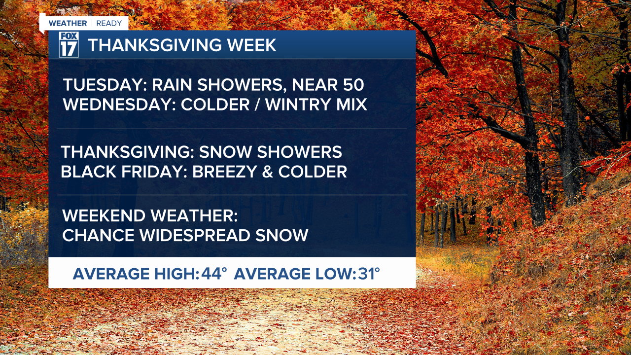
TUESDAY
Widespread morning showers will leave by 1 P.M.. Expect quiet conditions until after midnight, when more light rain arrives before the big wave of cold air.
WEDNESDAY
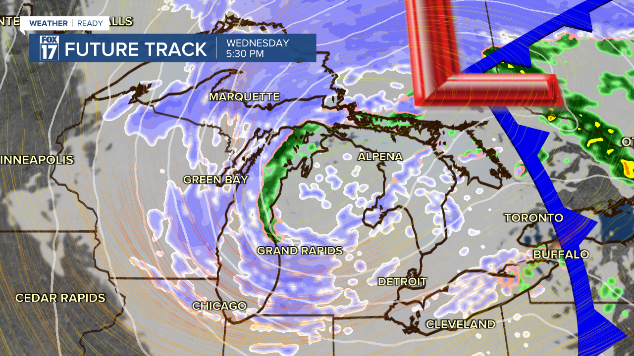
Light rain early in the morning will change to snow behind a cold front. Breezy winds out of the west may help ignite lake effect snow late in the day with an afternoon high in the upper 30s. If you are heading to the Upper Peninsula, widespread heavy Lake Effect Snow is likely. In addition to snow, the wind will make temperatures feel like the 20s.
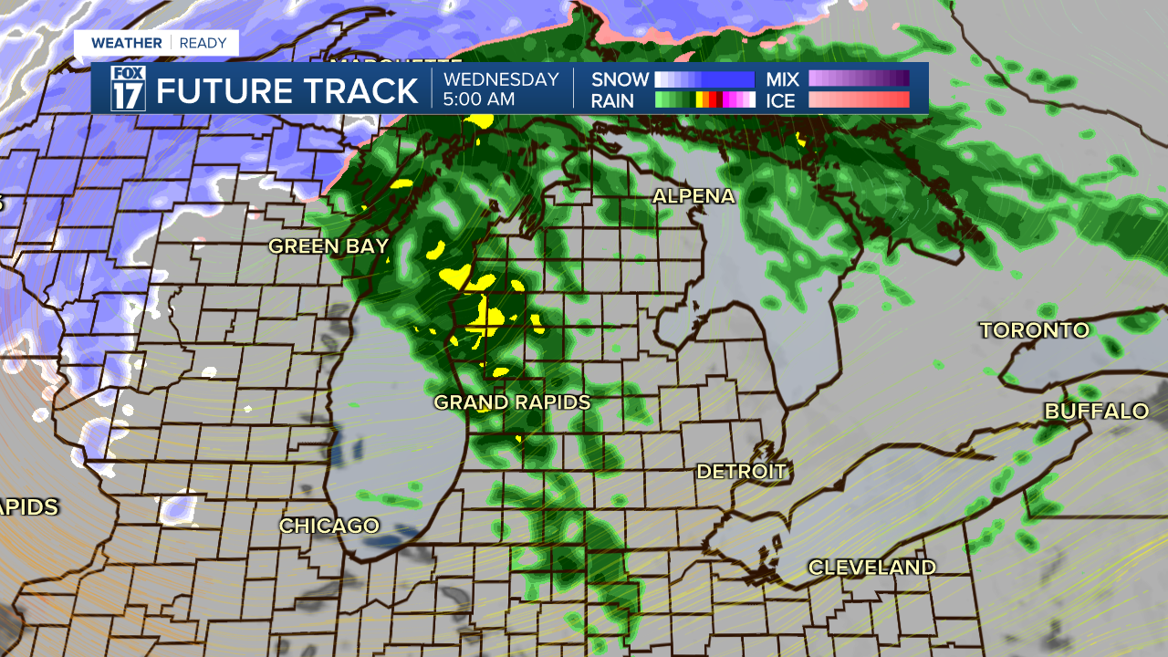
Expect low visibility, snowy or slick roads, and wind chill in the upper teens and lower 20s.
THANKSGIVING DAY
Chance of lake effect snow. Regardless, it will be cold and breezy with highs in the lower 30s, and wind chills in the 20s. Bundle up!
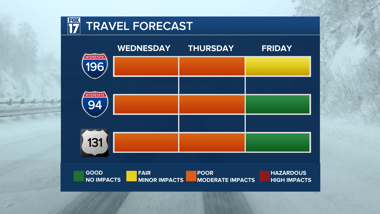
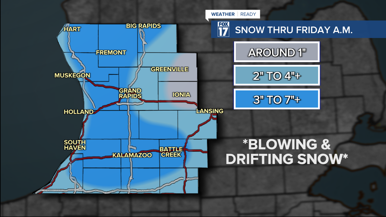
Keep in mind, this meter is SUBJECT TO CHANGE as high resolution model data comes in. The strong west wind might put the highest accumulations along 131 instead of west!
BLACK FRIDAY
Windy & cold conditions are expected to remain in place to end the week. Highs in the low 30s with wind chills in the 20s. Chance lake effect snow.
WEEKEND WEATHER
Another low pressure system may roll through the region for the weekend, with the potential for widespread accumulating snow to finish the holiday weekend.
LOOKING AHEAD
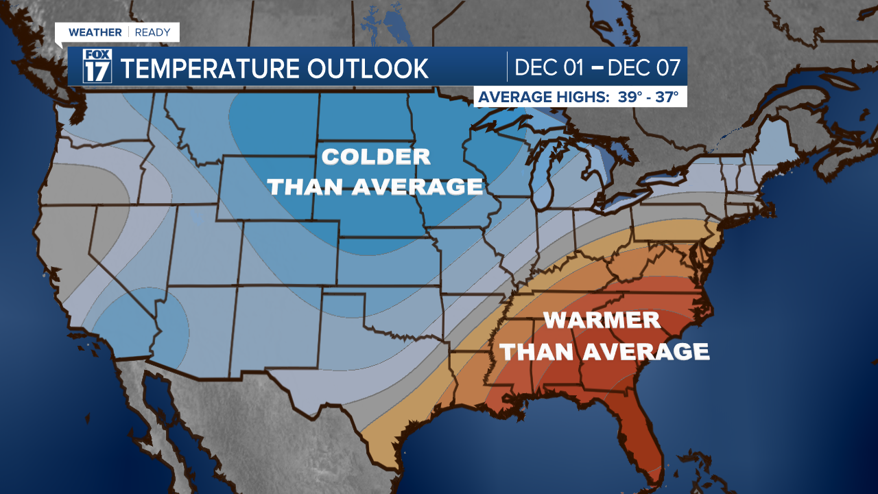
A much colder pattern is likely through the first week of December, which would likely bring several more rounds of Lake Effect Snow into the region.
For the latest details on the weather in West Michigan, head to the FOX 17 Weather page.
Follow FOX 17: Facebook - X (formerly Twitter) - Instagram - YouTube
