


WEST MICHIGAN — If you've been patiently waiting for a warmup, this week is the week! Temperatures will really be surging, especially by Thursday and Friday.
Even with a few cooler days early this week as a dry cold front passes through, temperatures will be reaching well above average most days. The Climate Prediction Center has high confidence of above average temperatures for the eastern half of the country, including West Michigan, in the 6-10 day time frame (above).
A couple of things are factoring in to the warmup, at the surface and upper levels.
At the surface, a high pressure over the Mid-Atlantic is creating "return flow" on the back side, right over us. This breezy southwest wind is pulling up warmer air and with lots of sunshine around, it will be easy to warm up into the upper 50's tomorrow. Tomorrow's forecast of 58 will be the warmest day of the year up to this point! Average highs this time of year are in the low 40's.
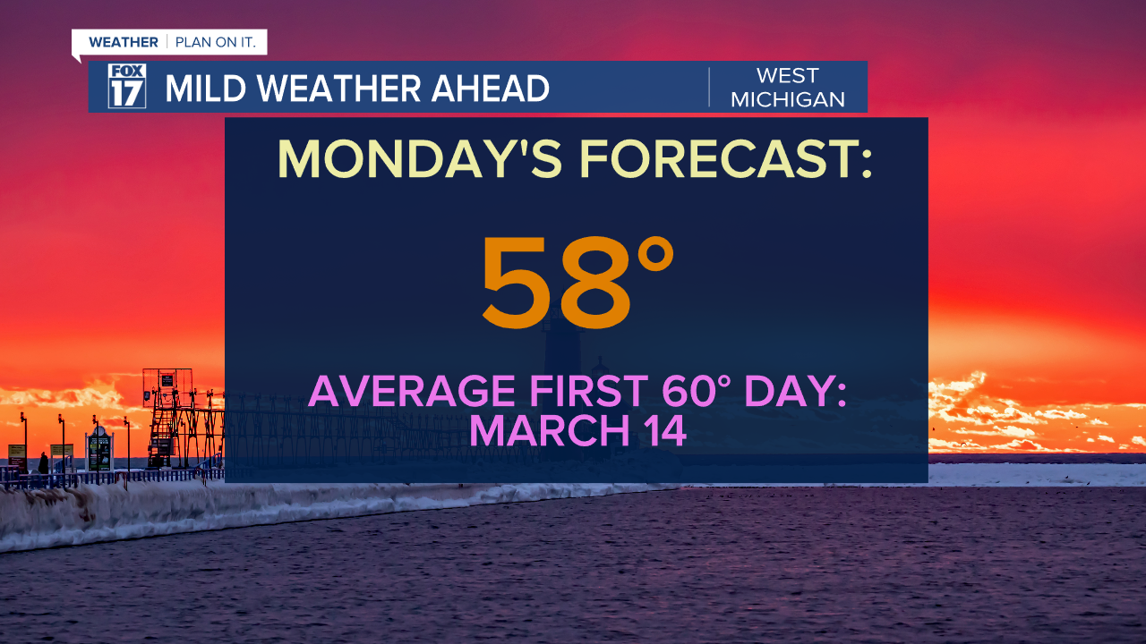
The typical first day with a 60 degree high in West Michigan is March 14, so we are pretty close to this date.
A dry cold front early Tuesday will bring cloud cover and a wind shift from the southwest to the northwest, and cooler air will flow in behind the front for Tuesday and Wednesday. Even with mainly sunny skies highs will end up in the upper 40s, and that will be the coolest stretch of the week!
Another surface high pressure sets up over West Michigan Thursday, and the wind change back from the south will help bring temperatures back in to the upper 50s. At the same time a ridge of high pressure nudges in from Texas and the Deep South to promote a warming trend (below). , bu

We will be on the edge of the warmest air Thursday, but the warm air advection increases Friday as a big low pressure system organizes in the Plains. This setup continues to pump in warm and more humid air from the Gulf, and will make Friday our warmest day of the week ahead of the powerful low. There will likely be a few spots that make it into the 70s on Friday! The average first 70 degree day is April 3.

This low will be the one that creates steady rain and even some thunderstorm potential in West Michigan on Friday night and Saturday! Stay with Fox17 for the latest details on this system.

For the latest details on the weather in West Michigan, head to the FOX 17 Weather page.
Follow FOX 17: Facebook - X (formerly Twitter) - Instagram - YouTube