


Arctic air will continue to grip West Michigan through Monday. Expect high temperatures to struggle into the upper teens, wind chills for much of the time to remain near or below zero. The lingering lake effect snow showers will continue to diminish.
Because of the intensity of this early-season cold blast; icy travel conditions and occasional bands of lake effect snow showers, the FOX 17 weather team is continuing a Weather Ready Alert through Monday morning.
Even though the Winter Weather Advisory is set to expire at 11AM Sunday, roads will remain icy in many locations, especially in rural areas.

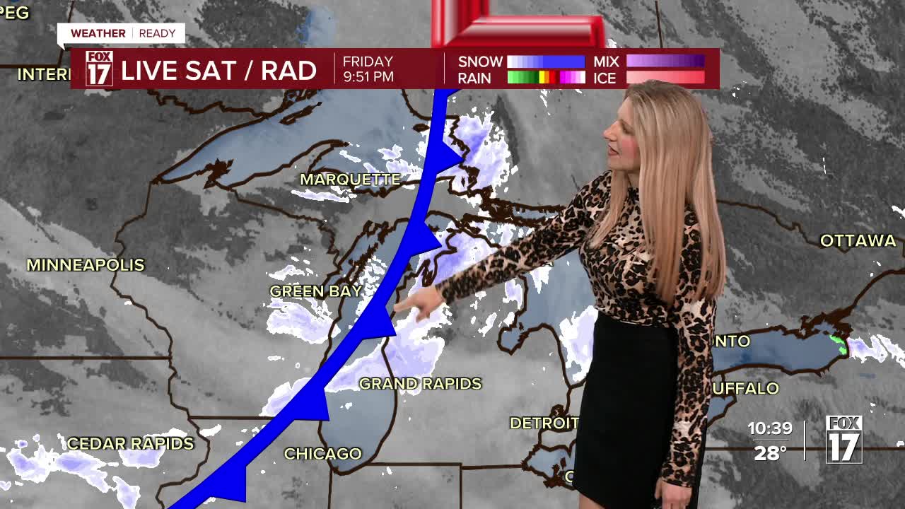
THE FOLLOWING INFORMATION IS A RECAP OF CONDITIONS SINCE FRIDAY NIGHT
Most locations picked up around 1 to 3 inches Friday night into Saturday morning, with a few spots receiving nearly 4 inches. Travel will be especially icy, since temperatures are below the threshhold where the salt and melting agents are effective.

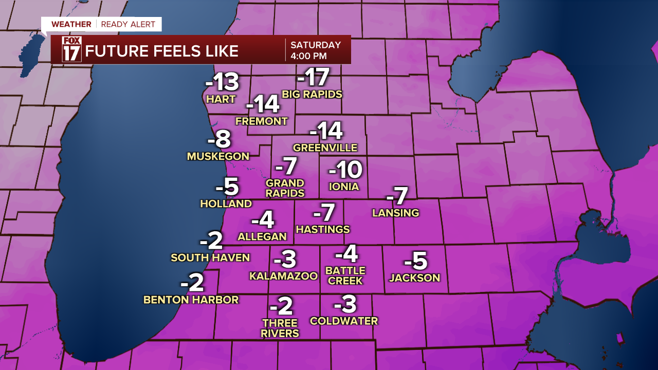
The arctic air entering West Michigan will drive our temperatures into the teens Saturday, with lows into the single digits Sunday and Monday mornings. Feels like temperatures will drop below zero Saturday morning, and likely stay feeling below zero through the bulk of the weekend.

The winds will be anywhere from 15 to 25 mph from the northwest all day Saturday.
Here is a look at expected additional snow amounts from Saturday afternoon through Sunday night.

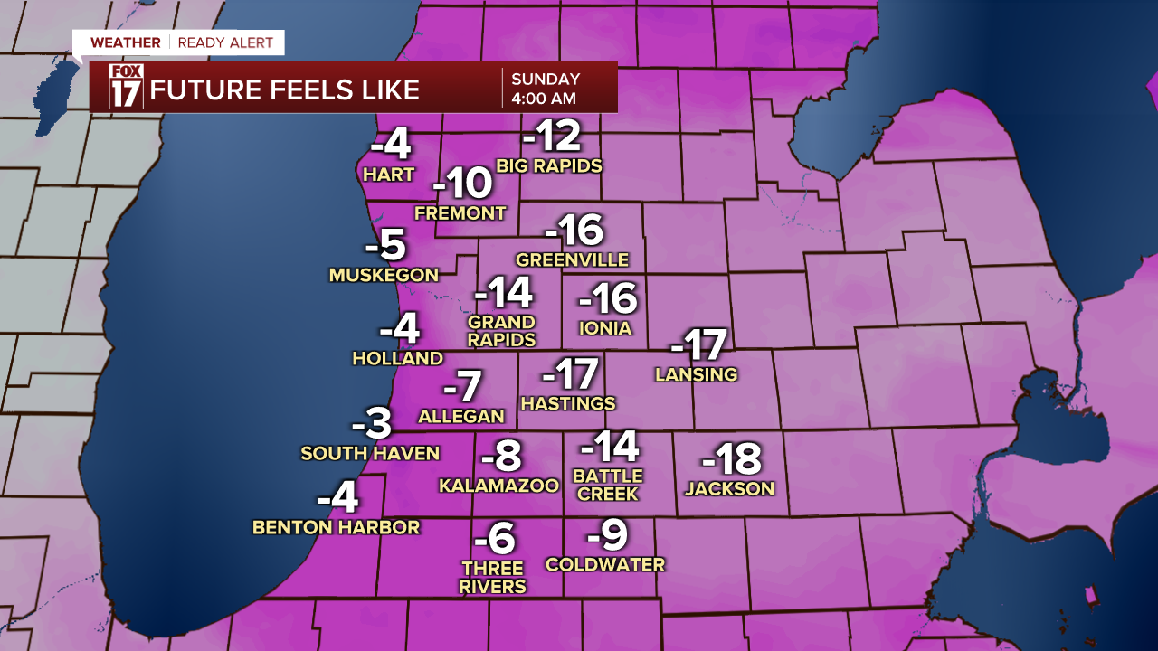
Sunday morning will again feel below 0, but most will feel around 5 during the afternoon as highs climb into the low 20s.
The cold snap won't last forever. A moderating trend is in sight, with highs next week approaching 40-degrees!
For the latest details on the weather in West Michigan, head to the FOX 17 Weather page.
Follow FOX 17: Facebook - X (formerly Twitter) - Instagram - YouTube
