


Another WEATHER READY ALERT is in place through the weekend for accumulating snow, poor road conditions, and dangerously cold wind chills. Tonight through the weekend snow takes a back seat to the dangerous cold and wind chills that will stay between -15 and -25 for an extended time (above).
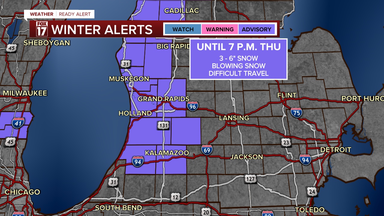
Some spots along the lakeshore received 7-11" of snow last night into this morning, and another 3-6" is ahead. This WINTER WEATHER ADVISORY continues through 7 p.m..
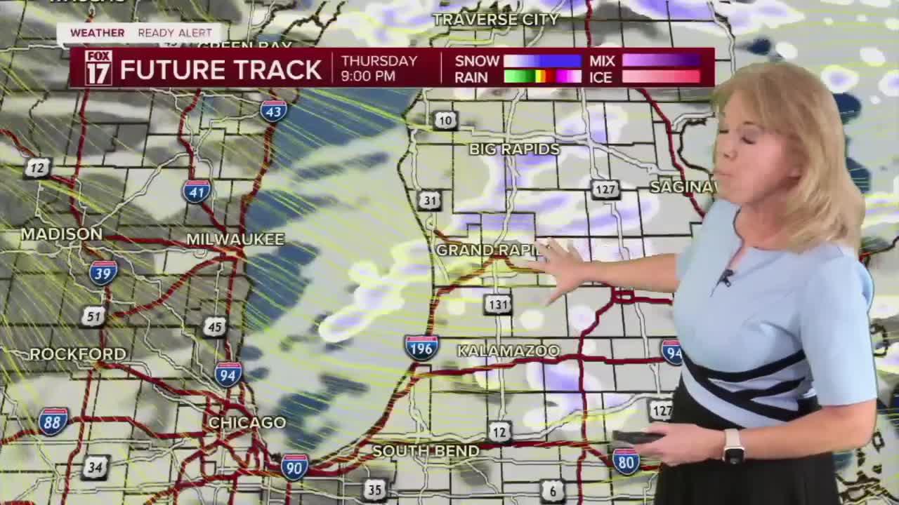
Snow will come in several waves: this morning, this afternoon, and this evening.
Heavier, more widespread snow moves in overnight along a cold front, with road conditions worsening. Snow covered roads and low visibility from blowing snow is expected.

A snow break happens for most through the mid-morning, but pockets of lake effect snow will be ongoing in a few spots.

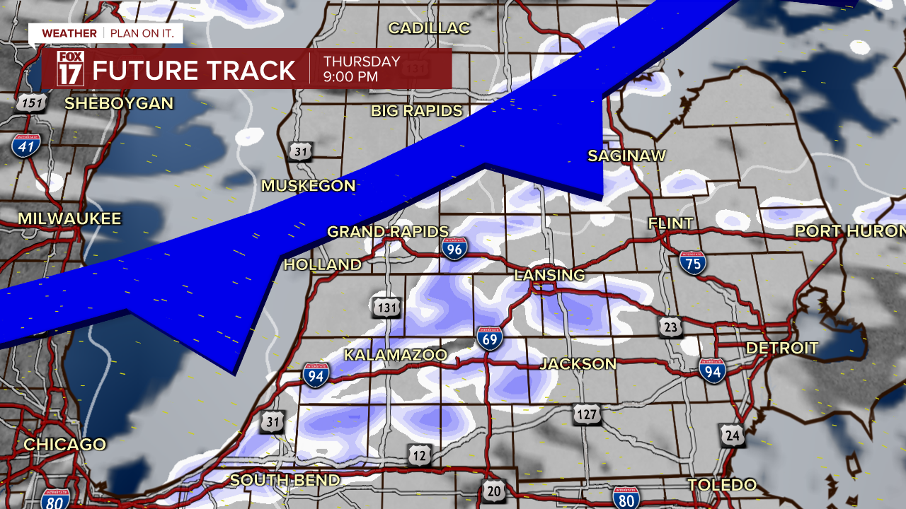
By late evening, a second cold front will reinvigorate snow showers.

Accumulation will be lighter with this round since the air will be significantly colder, but that means low visibility and blowing snow are more likely as the flakes are more easily blown around.
Once this front moves through, temperatures fall dramatically as air from the North Pole slides in. At the same time, winds will pick up, leading to dangerously cold wind chills. The combination of near-record cold and wind has led to the Extreme Cold Advisory (top of page) from tonight through Saturday .
Waking up Friday morning, wind chills will be in the -15 to -30 range for all of West Michigan. Frostbite can happen in less than 30 minutes at these wind chills, so limit time outside and cover all exposed skin. Pets and outdoor animals need a safe, warm place during this time as well.

It doesn't get much better Friday afternoon, with wind chills remaining around -10 to -15.

Friday's actual morning low will be around -2, with highs around 9. The worst of the cold arrives Saturday morning with ACTUAL temperatures around -5 to -10, which is close to record breaking cold. Wind chills will also be -15 to -25, similar to Friday morning. Highs Saturday afternoon top out in the single digits, with wind chills around -5.
For the latest details on the weather in West Michigan, head to the FOX 17 Weather page.
Follow FOX 17: Facebook - X (formerly Twitter) - Instagram - YouTube
