


WEST MICHIGAN — FOX 17 has issued a Weather Ready Alert for today...Thursday, April 2 due to the risk for strong to severe thunderstorms in West Michigan. This will be as a warm front lifts north during the day, followed by a cold front in the late evening/overnight.
The Storm Prediction Center has highlighted all of West Michigan in a level two slight risk (yellow) for severe thunderstorms (see image below).

All types of severe weather will be possible: damaging wind gusts will be the primary threat, but hail larger than 1" and tornadoes are both possible as well. There is more spin in the atmosphere with this system than with previous systems.
Here is a look at the FOX 17 Weather Ready Future Track for Thursday morning. Scattered showers are likely to start the day, with pockets of light freezing rain north of I-96.
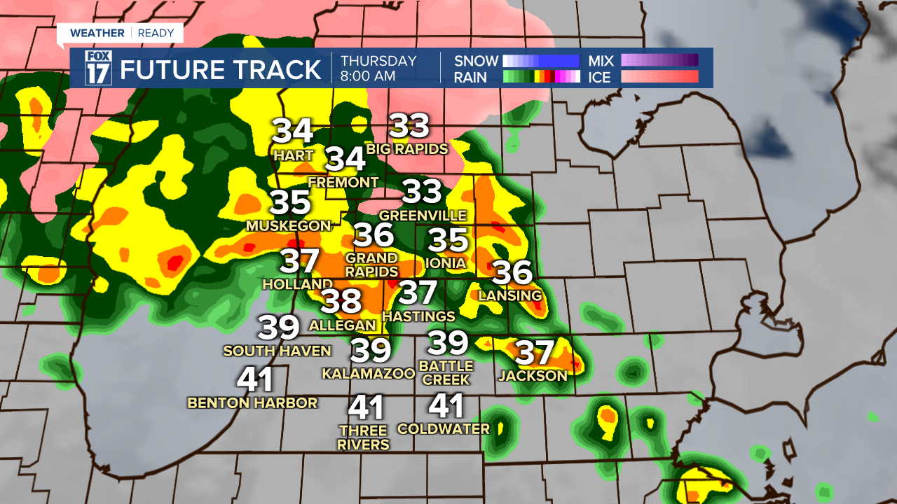
A lull in the precipitation is expected during late morning and early afternoon. Once the warm front lifts north in the mid afternoon, temperatures soar from the 40s into the 60s.

Once the warm front lifts north in the mid afternoon, temperatures soar from the 40s into the 60s, with some spots in the low 70s. A line of storms will move in from the west, with all severe hazards possible.

Those storms will continue to move through West Michigan during the evening, with wind, hail and tornadoes possible.

Another line of storms around midnight will have the potential for gusty winds as well, especially near the lakeshore.

Rain and storms will come to an end early Friday morning.
Stay with FOX 17 for more updates as we get closer to another chance for severe thunderstorms in West Michigan.
Want alerts when inconvenient or severe weather is headed your way? Download the FOX 17 Weather app and set up notifications for where you live.
For the latest details on the weather in West Michigan, head to the FOX 17 Weather page.
Follow FOX 17: Facebook - X (formerly Twitter) - Instagram - YouTube
