WEST MICHIGAN - For years our FOX 17 team of Meteorologists have been reporting on CLEAN AIR ACTION days, a time when the quality of our air is reduced. That said, our air quality is reduced for different reasons this time versus the traditional way. When an AIR QUALITY ALERT or CLEAN AIR ACTION day is issued, it's usually the result of fine particulate matter suspended in our atmosphere spewed from factories in northern Indiana, Chicago, and southeastern Wisconsin, or ozone production over Lake Michigan that presses inland. That poor air quality is transported across Lake Michigan and gets stuck here in West Michigan, especially with light winds and stagnant air. It almost always related to ozone.
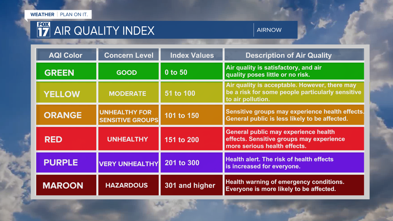
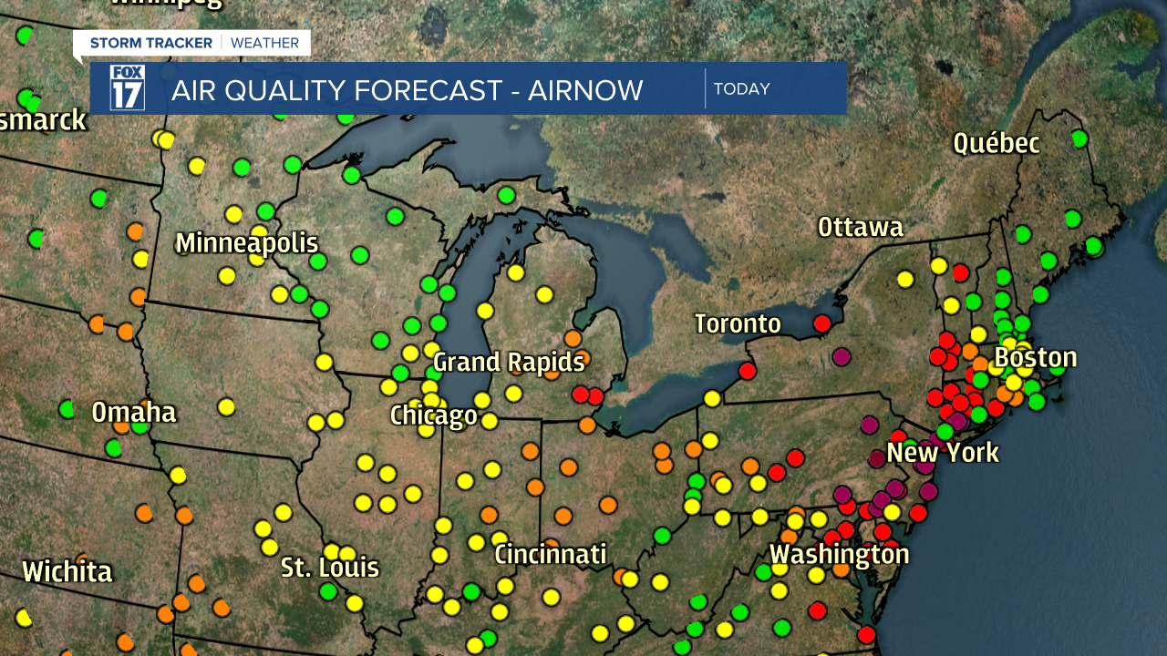
This time, our reduced air quality is coming primarily from the northeast from hundreds of wildfires in eastern Canada drifting south into the Great Lakes. The hazardous or "toxic" concentration of this smoke and fine particulate matter is NOT in our area, but further east along the Northeast United States, New England, and along the eastern seaboard. As the quality of air is ranked by AIRNOW...a government entity, from zero to 500, we typically see concentrations of 101 to 150 when a clean air action day is issued. That means "orange" or unhealthy for sensitive groups like the elderly, very young, or those with respiratory issues. This is when a CLEAN AIR ACTION day is issued. Compare that with New York which briefly spiked to 450! See chart below.

See the image below for the counties currently under a CLEAN AIR ACTION day (shaded in gray). It's all of central and southern lower Michigan. We expect higher concentrations of particulate matter and poorer air quality today than usual. Oceana and Newaygo Counties shaded in pink are under RED FLAG WARNINGS...burning is not advised in these areas especially. We should refrain from running gas powered lawn equipment, or topping off the gas tank. Both contribute to ground level ozone or bad air quality here at the surface. Try car pooling or using the bike.

Take a look at our forecast smoke model for both today and Friday. Images are below. Highest concentrations of smoke are NOT in our area, but over Detroit and Northeast United States.


You may be wondering exactly how this smoke can penetrate this far south. Well, the set-up in the atmosphere has to be just right...and it is! We can thank the atmospheric upper level pattern known as an OMEGA BLOCK. This block looks like the Greek sign omega (like a horseshoe), and "blocks" movement in the atmosphere from west to east. So things are literally stuck...hence the very dry conditions the past two weeks. Additionally, the Great Lakes remain under the dry portion or high pressure ridge of this block, while both sides of the ridge are flanked by low pressure systems. One of these lows is situated over eastern Ontario Canada. Remember the circulation around these lows...in a counterclockwise fashion. That means air, smoke, particulate matter, and anything else is being funneled or filtered south into the Great Lakes and Northeast United States. See image below.

It appears as if this pattern will break down this weekend and we have good rain chances, especially Sunday and Monday. See our model output for precipitation totals below. While our models don't agree on amounts, they agree on a somewhat widespread, prolonged rain.


Hopefully this rain will alleviate our ABNORMALLY DRY conditions across the area. Get the complete West Michigan forecast at www.fox17online.com/weather.


